MyHimalayasimpressions from |
|
|||||||
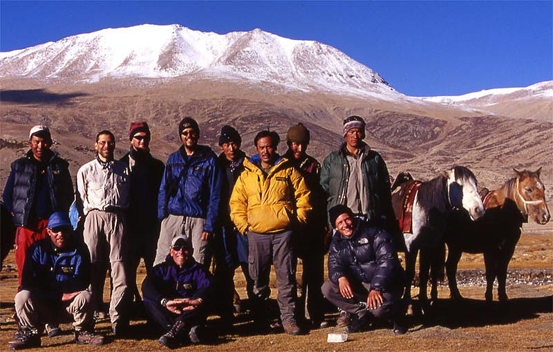
Crew, happy trekkers and two of the horses.
Starting in the village of Shang Sumdo we walk towards the snow peaks and our first
pass, Gongmara La.
In a barren, colourful world of rocks we follow the the little creek, the bushes in the
dried out bed add even more colours.
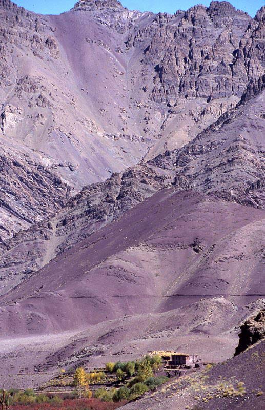
Shang Sumdo valley features brilliant colours and sharp contrast.
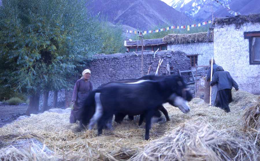
Harvesting season needs to be finished before winter will arrive soon, therefore people
work well into the night.
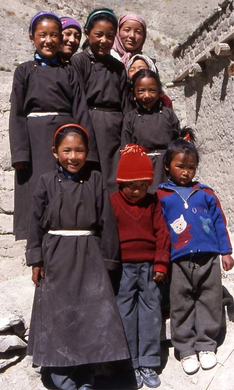
School and kindergarden in Chukirmo
The creek is a little rivulet in autumn, making progress easy.
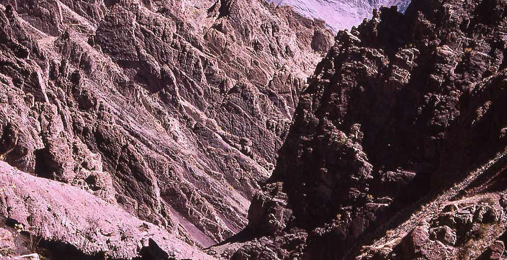
Enormous gorges in beautiful colours leave lasting impressions on the first days.
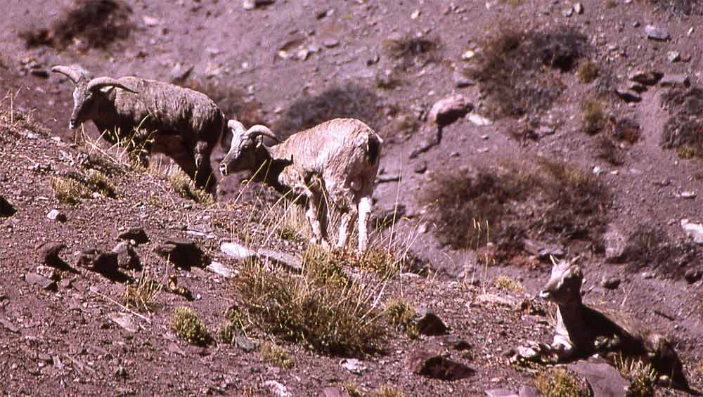
Blue sheep were as surprised as we when we met; the rare animals let us come
surprisingly close.
On top of the gorge we sat up camp and headed up the snow-covered pass the next day.
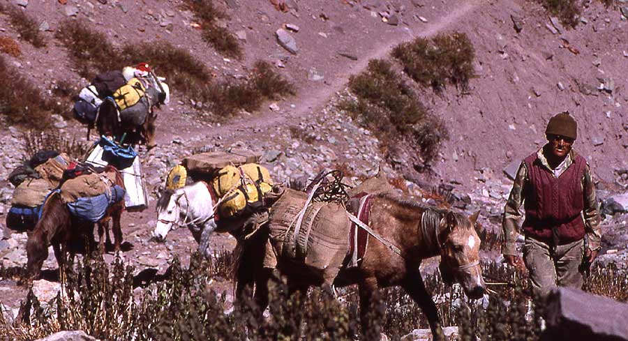
Tenba leads the horses to our third camp at the foot of a pass.
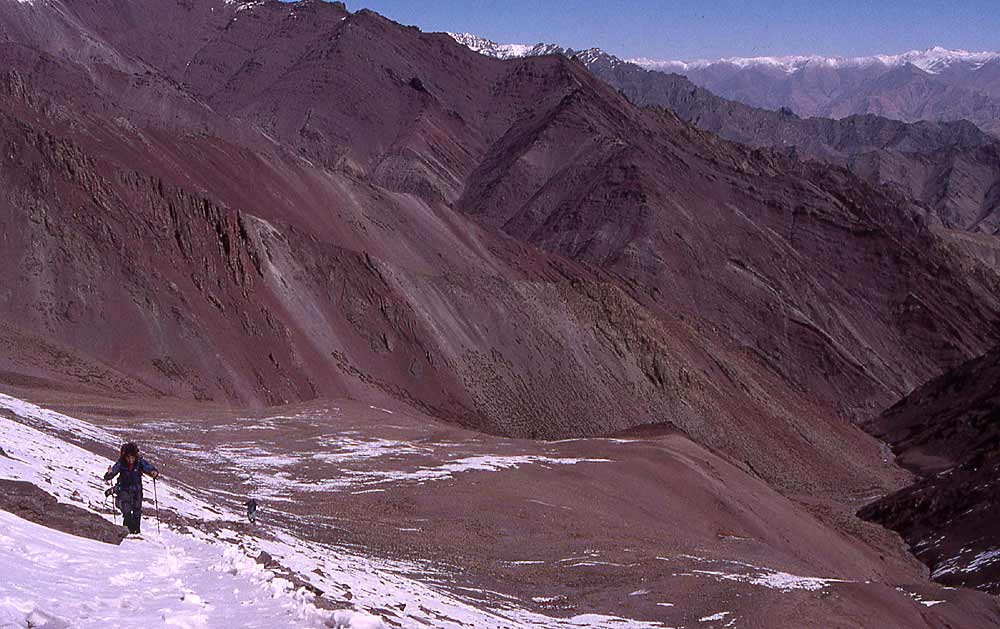
Way up to Kangmara La through hard-frozen snow, the Ladakh range that forms the border to
Tibet lies in right background.
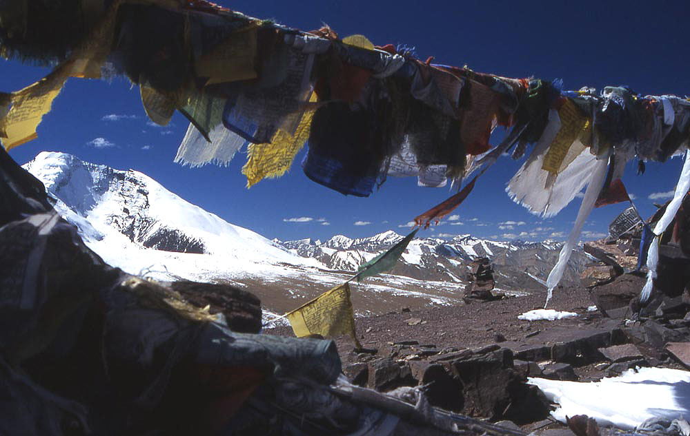
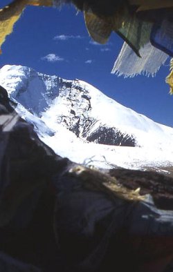
View from Kangmara La towards Kang Yaze and the Zanskar range to the right.
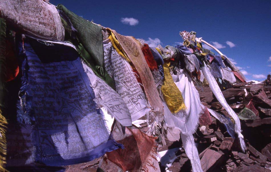
Prayerflags mark our first 5'000 meter pass, many more will follow in the next two weeks.
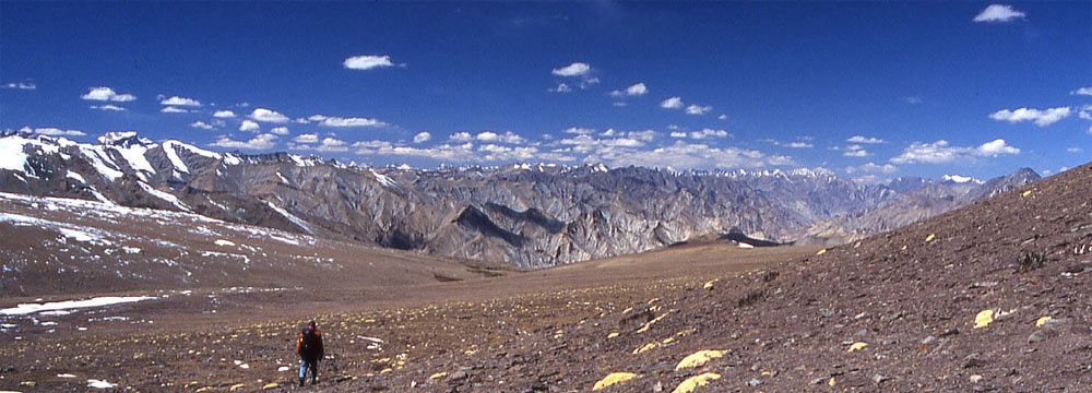
Joel descends to Nimaling, a grazing area during summer. The canyons of Zanskar in the
background.
Wide alpine valley of Nimaling serves as grazing area in the summer, but we don't meet
anybody except the only two trekkers we'll see during the entire trek.
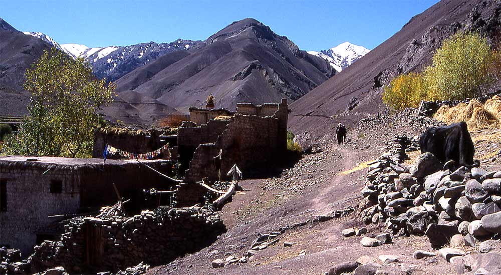
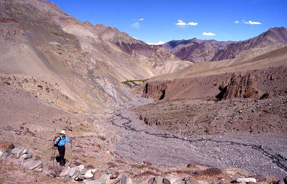
Walking through narrow canyons to Hankar.
Tso Moriri: Shang Sumdo - Hankar - Kangmara La
Shang Sumdo - Kangmara La
Shang Sumdo - Chukirmo (Day 5)
The hot water bottle at the bottom of the sleeping bag was too hot for a long, long time, and I am snuggly warm. Despite a barking dog I sleep surprisingly well, usually I need more time to get used to spending nights in tents. It is shortly before sunrise when I wake up, but since it will be another hour before the sun reaches the campsite, I doze for awhile. Then I open the tent to watch the valley wall glowing in an orange light. The vegetation is bathed in even more saturated colours than yesterday evening.
After a good breakfast in the sun I clear out the tent and start packing - as usual it will take some days before becoming efficient. Since we have to wait for Joel to catch up from Leh, I walk up the valley where a monastery lies hidden behind a small forest. The local school must also be there, half a dozen children from the village wave as they pass us on their way.
Just the scenery alone is worth the short excursion. A rugged cliff consisting of mangled layers of rock in various reddish colours builds the valley’s end. In the middle of a forest of poplars stands a large white compound - the monastery. A nun opens the small prayer room that contains books, thangkas and a large number of butter figures (tormas). The large assembly hall on the ground floor remains locked, the key-keeper has gone out. So we sit on the balcony instead, enjoying the warm morning sun and a pleasant conversation with the nun.
While we sit there and chat (Nicole's Tibetan is great, mine not too good), an old monk joins us. His room is upstairs and not in the courtyard like the monk’s cells. He might not be the official abbot, nevertheless he is a figure of authority and charm. Despite his age - he claims to be 85 years old - he enjoys good health, and maybe just as importantly, is in good spirits and the many wrinkles on his face deepen when he smiles or becomes thoughtful. 40 years ago he visited Central Tibet and studied in Drepung monastery, one of the three main Gelugpa centres that attracted 6'000 students from all over Tibet. He travelled by foot and the journey over the vast Tibetan plateau took him 4 months. His travel journey would be more interesting than mine, but due to my limited language skills and lack of time his story will probably never be told.
After coming back to Ladakh he settled down in this monastery and hasn't left it since. This is a little branch of the main gompa in Lamayuru and Spituk, which belongs to the Gelugpa sect. The nun told us she practises the Drugpa tradition, a school that was widespread in Bhutan and Ladakh once. This lead to military alliances to protect themselves from the Gelugpa-governed Tibet, but couldn't protect Ladakh from being forced to accept Tibet's influence. The rules of Drugpa are less strict than the Gelugpa, but I have never heard of nuns and monks sharing the same monastery. I'm also confused because I thought that Drugpa is part of Kagyu and not Gelugpa (the sect of the two 'parent monasteries'). The compound is well kept and hosts 20 monks and nuns, but only three are currently staying here. The others are further south, if I understand correctly somewhere near Simla. We decline offers of tea, instead eat some small but very sweet apples and leave with many wishes for good luck on our journey. The horses are still being loaded when we arrive back at camp to begin our first walking day.
What a start! We pass the traditional whitewashed houses of Shang Sumdo where people continue with the harvest work. At the town's end a little trail marks the beginning of our route. My excitement grows as my eye follows the path in the middle of the reddish slope. It disappears behind a curve and must climb up from there to a pass between the snow peaks that stand out against the blue sky.
The trail runs above a meandering creek that flows in a wide riverbed covered by colourful bushes. The red colour of rocks is contrasted by barren hills of slightly different colour and the dark blue sky. Just the colours alone are incredible. Walking is easy and we slowly gain altitude, when the valley gets narrow we descend to the creek and follow along its dry bank. Only little water is flowing at this time of the year, this spares us risky river crossings that are probably necessary in summer.
Despite the short distance we'll cover today, Lobsang has set up lunch and waits for us below a cliff. Trekking in Ladakh is a little different than in Nepal. Standard luxuries like bed-tea and hot washing water are 'only' served on request. You put up your own tent, and instead of a two-hour lunch break we only stop for half an hour to eat pack lunch. I prefer this more simple style, though there will be days when I miss a filling hot lunch of dal baht. Usually we have chapatis with sun-dried tomatoes, cheese from Manali, and some salad; wrapping it all up makes good sandwiches. For dessert we simply have some cookies.
After lunch it gets a little more strenuous, walking in the riverbed requires more attention, the sun shines pretty hot, the trail is less even and the altitude slows us down. There are fewer houses and fields, instead rock faces and bizarre natural stones figures dominate the scenery. The valley is barren except for a line of trees growing 40 meters above the bottom of the gorge, indicating an irrigation channel. The village of Chukirmo, featuring prominent on the map, is just a few isolated houses. The smallest building, set a little outside, is the school. Boys and girls aged 5 to 12 are taught by a local woman, both teacher and students enjoy going to school. Two girls finish their test inside, after a quick check of their work the teacher 'arranges' the kids for a picture. They do not understand my German-Lhasa dialect of Tibetan, after a short conversation in English and a small donation it's time to go on.
The horses have overtaken us and wait on a little plateau overlooking the river that looks like the entrance of a narrow gorge. The wall to the left is already quite steep, on our right are barren slopes with some thorny bushes. To my surprise there are a dozen fairly large animals grazing higher up, they can't be horses and after looking more carefully I realise it's a flock of bharal - blue sheep. They can be found all over the Himalayas in the more remote areas. They scared me the first time I almost stepped on them in a narrow gorge in Mustang. During the next encounter in Dolpo they were grazing on slopes high above Shey - supposedly they are 'abundant' in Ladakh and hopefully I'll see them from closer in the coming days. To me they’ve become a sight I associate with remoteness. So even the distant glimpse makes me content.
After unpacking the horses, Tenba the horseman leads them to the slope across the river where they are left alone to roam and graze until the next morning. Hopefully there won't be any wolves around, or the horses decide by themselves to wander too far.
A white chorten watches over the quiet valley. A stunning place to camp high above the river, views up into a narrow gorge and down towards the Indus valley, at the horizon the Ladakh range forms a mighty border to Tibet.
The stars shine brightly and accentuate the dark ridges against the bright sky.
Chukirmo - Lhatse (Day 6)
The horses didn’t seem to have strayed too far, when I open my tent they are driven down from the opposite hillside. Today's route will also be short and we take our time before setting out. The sun's radiation is strong already, making breakfast very enjoyable. Nearby is a little spring with natural mineral water, according to Lobsang it gives strong muscles (though he should have mentioned that he mixes it with whiskey). Chu means water, kirmo sour: the spring gave the village its name. The slightly salty and bubbly water is tempting not only for us, blue sheep also seem to like it. A flock finds a way down the steep rock face and descends to the spring to lick the sedimentation from the stones.
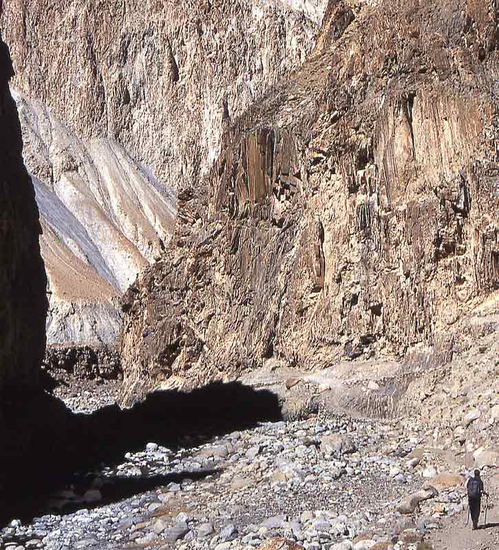
I try to approach them but they retreat, not in a hasty escape but in a gentle walk up the inaccessible cliffs. A little vegetation grows at the bottom of the gorge, apart from these bushes of rosebud it is just barren rocks. Fantastic colours and formations stretch into the blue, cloudless sky - increasing in sheerness the deeper we enter the gorge. A little rivulet flows in the wide riverbed, making crossings easy despite the thin, almost invisible layer of ice on the rocks. It must be cold at night, luckily I don't notice that in my sleeping bag.
An eagle flies high above and scans the rim for rodents. Some fluffy sparrows hide in the bushes, except their chirping a solemn silence lies in the gorge. The trail was repaired recently, making walking less tiring than the day before. The horses walk at the bottom of the gorge, we often climb up a little to circumvent narrow spots where you'd have to wade in the creek to get through.
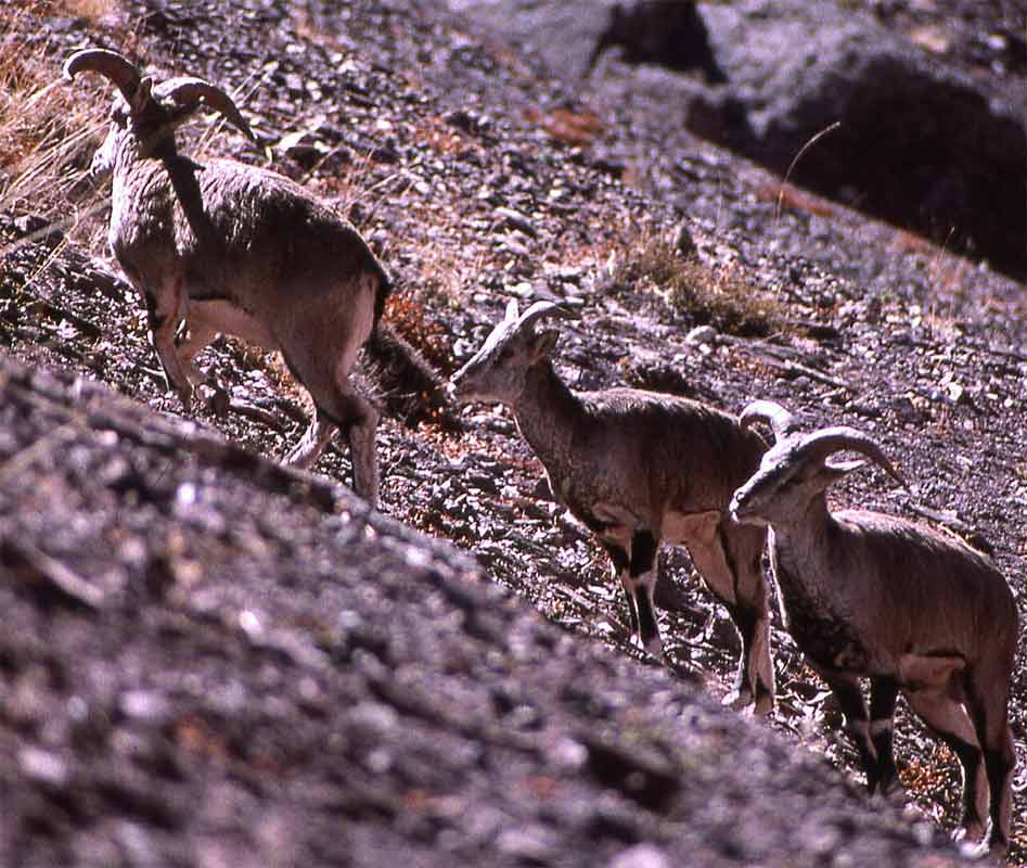
When the gorge opens up a snow-covered range rises ahead of us. As we get around the corner a cloud of dust rises from the trail. We've startled a group of 10 blue sheep that were grazing along the path. After some metres they stop, turn around and stand there watching us. Fleeing in open spaces is not a good option for them. Therefore they usually try to remain invisible, but when the potential attacker gets too close they try to reach inaccessible cliffs where they can't be followed.
We get within 25 meters to them and wait. Once their initial surprise is over, they continue grazing, only one young goat is sitting on the ground watching us. Both male and female animals feature horns of different shapes. We try to get closer and again they run away for some meters, then turn around, calm down and continue to graze. At some point their escape route is cut off and they flee down to the creek, cross it and are up in the middle of a steep cliff. A small female takes another route and has to cross the creek above the waterfall. It takes a big leap over the two boulders where the water falls down ten feet; in the background rises the snow-covered range. This elegant jump will stick to my mind only, because it took me too long to get the camera ready. Nevertheless, since I got other good shots I and am happy to have bought the 300mm lens.
The large distance these animals have covered in just a few seconds is remarkable. They know they are safe now across the creek and slowly walk higher up, out of the cliff and onto a ridge where they disappear on the other side. A few minutes later the tip of their horns reappear above the ridge, but they won't come any closer now.
From the waterfall to the campsite it's just a short walk. The snow ridge at the horizon will be our goal for tomorrow, right now I am tired enough to be happy about getting to camp. One last crossing of the creek, up a sidevalley and we reach a little plateau big enough for our tents. While enjoying pack lunch, the faint sound of a ringing bell announces the arrival of the lead horse.Our horseman suggests a better campsite further on where risk of rockfall is smaller. Just a few minutes later we reach another plateau with fine views.
It is early afternoon and the sun is fierce, but a cold wind makes the tent more attractive for naps than the outside. The four hours to dinner could be used to walk into a side valley toward Zanskar, but an easy afternoon for acclimatisation is more tempting. As the sun sets it becomes chilly, luckily soup arrives punctually at 600 and warms me up. Lobsang usually serves the food, whoever sits closest to the entrance gets his food first, but the corners are a little warmer and there won't be any food shortage. After a grand dal baht (both in taste and quantity) with paneer and vegetable curry I definitely have collected enough calories to make it through the cold night.
I stuff a hot water bottle inside the sleeping bag and step out to brush my teeth and watch the sky. By the time I'm ready to sleep it is cozily warm in the sleeping bag. Lighting a candle helps to warm the tent and creates a pleasant light for reading. A piece of chocolate adds to the perfect atmosphere. Not surprisingly, a few pages later I am already asleep.
Lhatse - Kangmara La - Tahungtse (Day 7)
Today will be our first test. Crossing the first high pass and descending on the other side will take more effort and time than yesterday. The plan for an early departure is changed due to the cold temperatures in the morning. We stay in our tents a little longer and wait for the sun. We're not the only ones longing for its rays, blue sheep are also coming down to warm up on the slope.
A little black line marks the trail that cuts through the white mountain flank, the ascent is technically easy but looks potentially strenuous. It seems straightforward and free of snow, but the huge white wall looks intimidating. At first I walk along the frozen creek, then the valleys turn left where the snowfield starts. Soon the snow covers the trail and makes it slippery walking. Lance goes ahead breaking trail and cutting footsteps. I prefer walking on the small band of snow-free stones along the trail, using the skipoles to balance when necessary. The walk is harder than expected, but when the last curve is behind us a long line of prayerflags announce the pass.
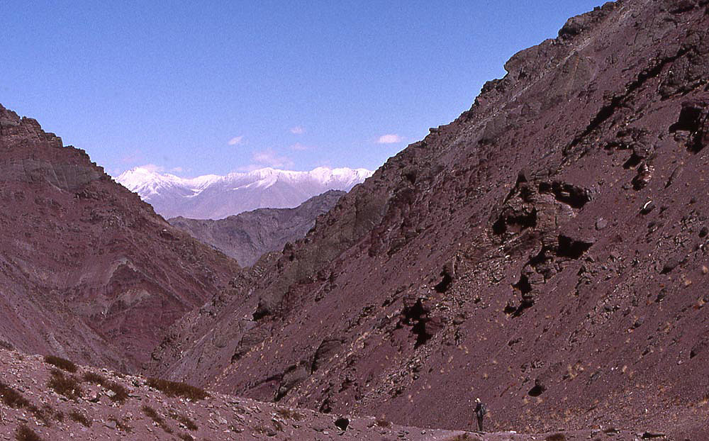
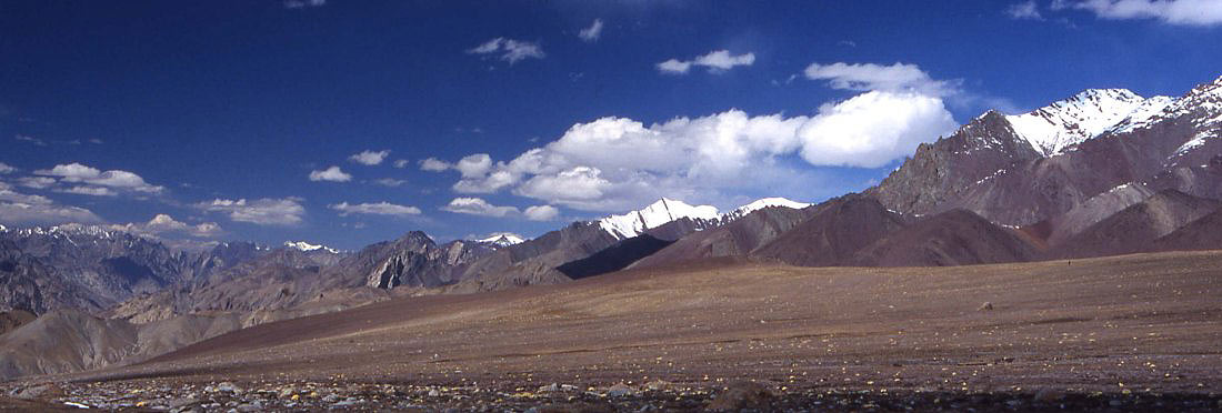
What a scenery! Pyramid-shaped snow peaks with gently curved ridges rise above a wide valley and its little meandering creek. Kang Yaze (6’400 m) rises above all of them, glaciers cling to its flanks. The Zanskar range ahead with its chaos of hundreds of rugged peaks, narrow gorges and washed out ravines is the most stunning and intimidating sight. The dark blue of the sky, white of snow and the dried yellow grass is a simple, but effective colour combination.
Looking back, our last three day's walk look less inhospitable than the scenery ahead, still it is hard to imagine that we've found a way up between the barren mountains. We're high enough to see above the Stok range and into the Indus Valley, and even a little further. The air is so clear that I even spot Chemre, a small monastery in a northern sidevalley on the way to Tragtok, in my opinion the most special of Ladakh’s monasteries.
The weather is perfect, the wind less cold than expected, and we spend some time on the pass until Lobsang arrives with lunch. The horses have trouble getting up the frozen trail, the horsemen unload them so that the strongest horse can break trail for the others. Some loads might even have to be carried by Tenba and Tenzing themselves. But Lobsang is confident that they will meet us at camp, it will just take them longer than expected.
This side of the pass looks like a gentle downhill walk into the large valley. The views are stunning, snowpeaks to our left, rugged canyons of Zanskar ahead, red ranges on our right. But most impressive is the feeling of vastness; there is endless space around us. Nimaling translates to ‘summer place’. The grass on the pastures makes it a good grazing ground during spring and summer. Now it is completely empty, and the few people in our group soon lose sight of each other.
Scenery is often best enjoyed in solitude – I let the others pass me, sit down and take my time to enjoy the spectacular landscape. There is no visible trail but eventually we all meet near the creek for lunch. After a hearty snack on the pass I only eat a little and am eager to leave. The sun is burning fiercely and I’ve already finished my two litres of water.
The canyons of Zanskar that seemed so far away are getting closer and reveal more and more details. It looks like a natural maze. The washed out valley to our right shows fine lines of erosion; black, grey, yellow and red rock layers are topped by a fine line of snow at the top of the peaks.
We have another stop at a small green pond and spot the horses that have just arrived on the pass. The sun starts to really irritate me, therefore I am happy when the valley narrows and we get the first shade of the day. Nothing reminds me of the wide pastures of Nimaling now, steep walls surround us and the narrow fissure ahead is the only exit into the next valley.
The valley floor here is fertile; people use the terraced fields to grow barley. Between the fields are three isolated stone huts that are all abandoned. Farmers and probably shepherds use them in the few precious summer months when glacial water and warm temperatures turn the barren hills into green meadows. When winter approaches, the shepherds move back to their villages.
Yet the windswept Nimaling is not devoid of life; at the pass I noticed small spiders, a little further down were some birds that resembled wagtails. Large hares or marmots have already started their hibernation, but I catch sight of a one-foot long tailless rodent that flees from one thorny bush into the next one when I try to follow it.
The horses have not caught up with us yet, and we decide to camp here. Soon afterwards the horses arrive, it was a tough day for them but the nearby creek and barley stubbles are a nice reward for them.
|
Summary Part 2:
After our first camp near a little hamlet in the Hemis sidevalley the trek starts on a perfect day. The trail runs above a meandering creek that flows in a wide riverbed covered by colourful bushes. The red colour of rocks is contrasted by barren hills of slightly different colour and the dark blue sky. The trail eventually climbs to a pass, Kangmara La, between the snow peaks that stand out against the dark blue sky. Scenery is often best enjoyed in solitude – I let the others pass me, sit down and take my time to enjoy the spectacular landscape: serene high alpine scenery is contrasted by the canyons of Zanskar that stretch as far as the eye can see. After descending the grazing area of Nimaling we find a good campsite at the foot of the Zanskar range. |
||
| (c) 2006, Carsten Nebel |