MyHimalayasimpressions from |
|
|||||||
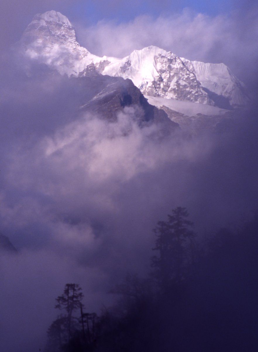
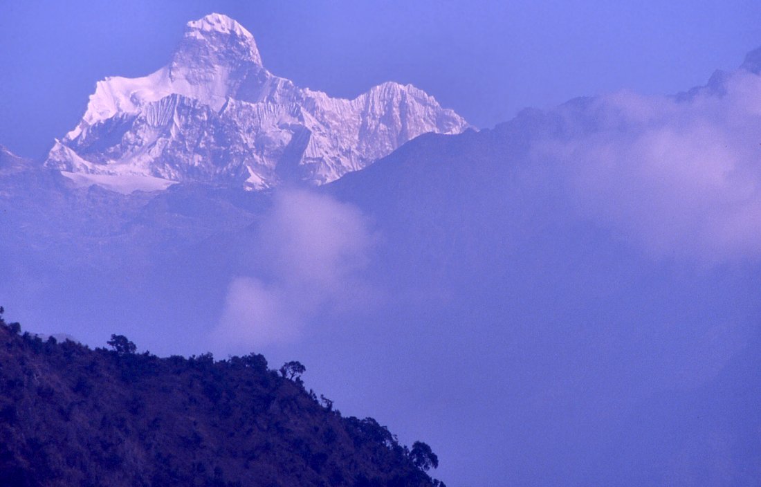
Fog moves in from all sides on the Lasiya Bjanyjang ridge, making the south
side of Jannu more magically.
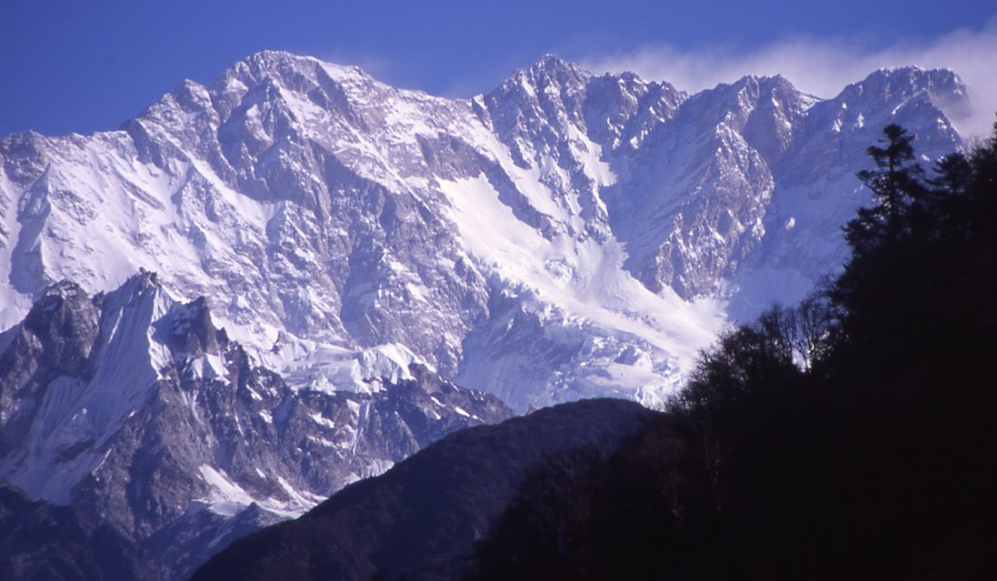
South face of Kangchenjunga in the clar morning.
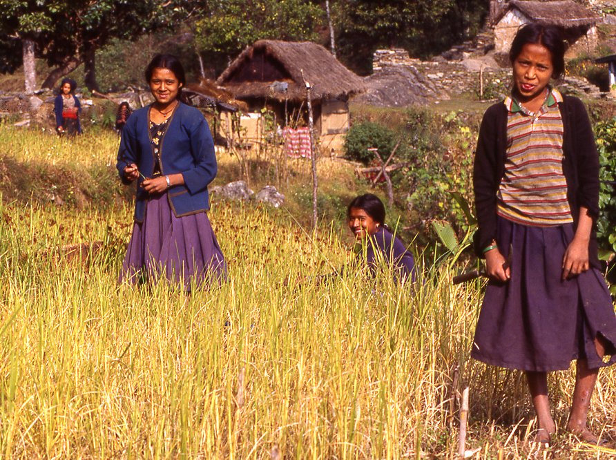
Ang Dami, guide and chef extraordaire, on the nice trail between the millet fields around Khesewa.
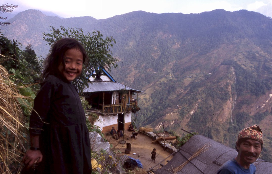
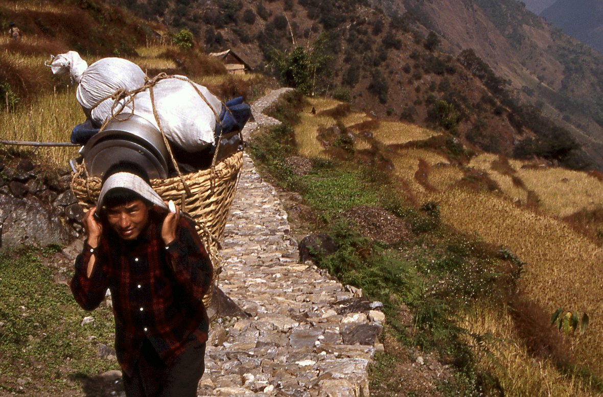
Villagers sell us local produce to spicy up our daily dal baht.
Harvest is in its last stages, the rice was cut and the corn is separated
from the sheaves by water buffalos.
Rice ripens first and has first priority, then people start with millet
harvest.
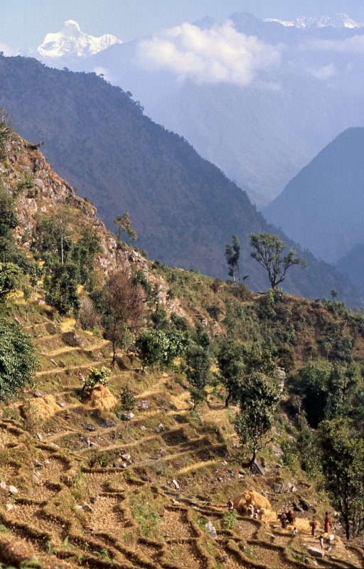
The farther we get away from the mountains the higher they seem to get.
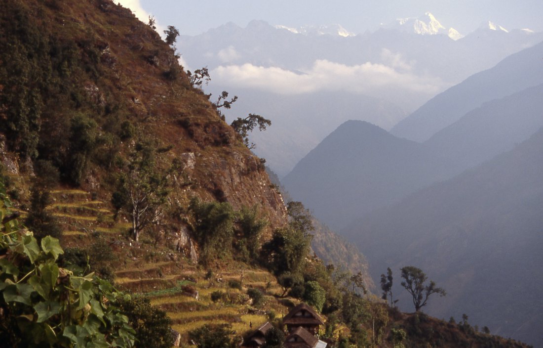
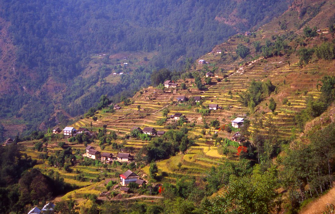
The ice and snow of the Kabru range contrasts icely with
the terraced fields of Phumpdanda.
Girls are harvesting millet, the rice harvest was finished a few weeks
earlier.
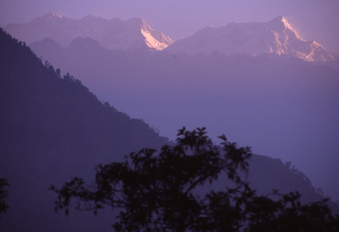
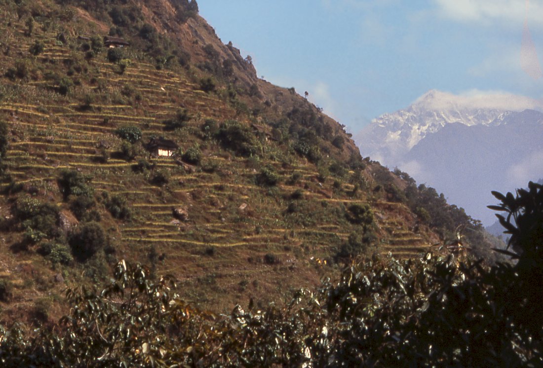
Kangchenjunga's south-east face catches the early morning sun as does Kabru,
seen from the last camp before getting back to Suketar.
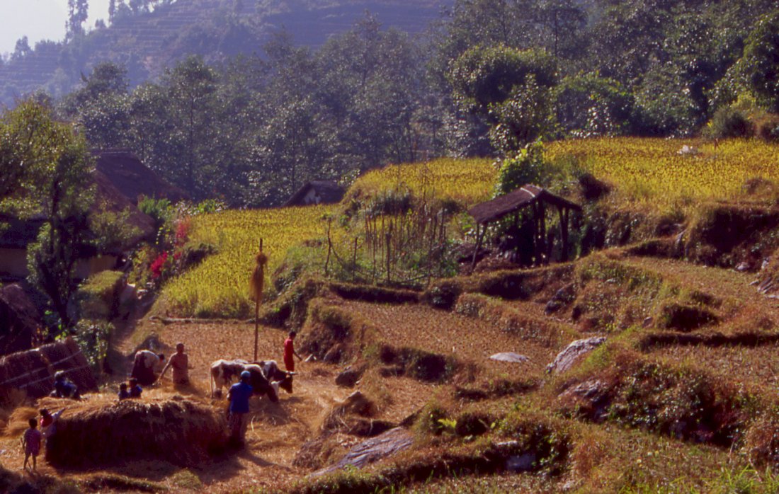
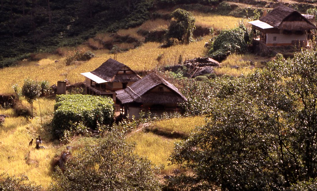
We pass harvest scenes all the way back to Suketar.
The last major village before the climb towards the end of the trek.
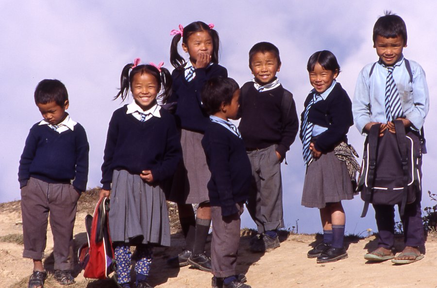
Kids on their way to school.
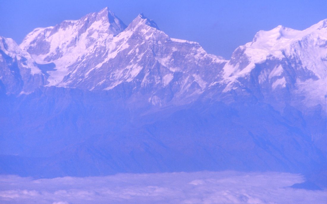
On the way home from Kathmandu to Delhi: Manaslu
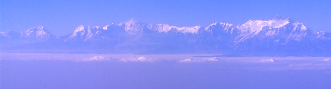
A few minutes later the entire Annapurna range and Dhaulagiri appear - just make sure you get a right window seat.
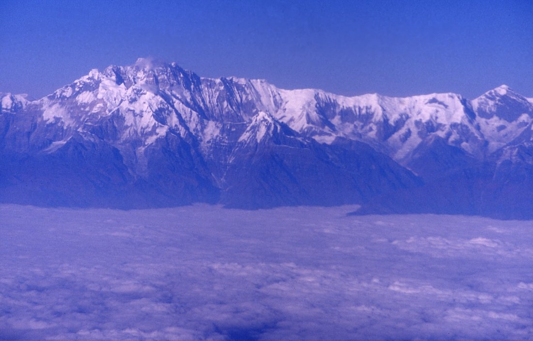
Annapurna south face from the airplane.
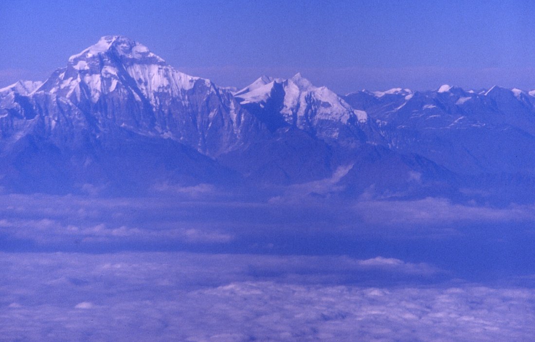
Dhaulagiri (8'167 m) is the westernmost high peak of Nepal that's visible
from the plane.
Kangchenjunga Olung: Lasiya Bhanyjang - Yamphudin - Suketar
Lasiya Bhanyjang - Yamphudin - Suketar
Lasiya Bhanjyang Yampedun (Day 27)
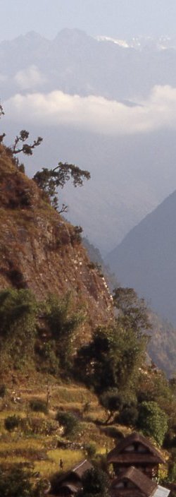
It was a foggy night, but the mist dissolves in the morning and I do get to see sunrise on the Kangchenjunga range. I rush to the next stone and mount the tripod. Lama whos just woken up looks at me a bit bewildered. Though more clouds move in, Ill try to find a better spot to watch the sunrise and I tell the crew to postpone breakfast till Im back. On the way to the ridge I disturb a surprising number of birds, most noticeable small ones with a nice song, and two large black ones with an even longer tail, one of them completely white, the other in a white zigzag pattern. A few minutes out of camp I climb the rhododendron forest up the landslide. At first only Jannu is visible, but from a little higher the connecting ridge between Jannu and Kambachen appears, and then the entire summit ridge with the south summit at the very right. A dramatic drop ends the massif in the east. Fog still comes over the ridge, but there are moments where the mountains are clear and only the trees disappear in the fog. To the west it is clear, two high mountains rise above the wooded ridge of Pasang Danda, probably the first two peaks of the Syamdo Kangri range.
After breakfast I come back to the same spot to get a last glimpse. Without clouds its possible to guess the trail we took from Ghunsa. If I didnt know we really did take that trail I wouldnt believe there was one. The trail here is surprisingly wide and well built. Its a quick drop down. Its like a staircase descending; the construction and maintenance must be immense work. Clouds hide the forested hillside to the north, in the south are several valleys in which roofs shine in the sun and little terraces cover the unforested parts. Autumn colors are less widespread than in the west, the few yellow maples and red trees stand out clearly from the various greens of firs. Patches of white clouds built up high above us, little clouds of mist have collected in the hillside and wander north. On the way we meet to tourists. The first porter is more talkative and seems to know Ang Dami. Shortly afterwards I see a known face walking up: Bagman, with whom I trekked around Manaslu and to the north side of Kangchenjunga. Its a nice surprise for both of us, after a 10 minute chat Ang Dami presses us to go on. Pictures, exchange of email addresses and were off. Bagman is the sirdar of the group; his English has improved a lot and also his self-confidence. Hes still very funny, but less jumpy and seems to have grown in the last three years which makes me happy.
We stop for an early lunch after two hours of downhill walking in Omjee. Since I dont carry any loads, Im the only one who enjoys the warm weather. A dejected looking older man runs the campsite and opens the kitchen. His wife could be the reason for his unhappiness: shes very brisk, yells at him and simply creates an atmosphere of misery. The lunch tastes good, but Im happy to leave.
Across the Omjee river were in a jungle where the sun doesnt penetrate the crowns of the broad-leaved trees. Man-high fern covers the slopes. Rivulets trickle over dark green moss-covered boulders and disappear in the ground, coming to the surface a few meters further down. Unlike yesterday the air is filled with sounds from insects and birds. Half an hour after walking through the jungle we climb up a last hill and are on clearing. Warm wind dries the sweat while we enjoy the view. The air is heavy with rain. Haze lets us see only contours of the hills that seem terraced. A small trail goes down the steep hillside, we have to retrace our steps once because the trail ends abruptly at a landslide. Further up we can cross and pass an isolated house, a very simple construction. Corn is laid out for drying, and three newly born calves are tied to the house. The fields are small and dont seem to get enough water. An old man lives here with his family. Its a few hundred more meters down to the bottom of the valley where a large number of yellow terraces indicate a more lucrative place for agriculture.
We were warned about a Maoist stronghold and training camp near Yamphudin, and have taken the old high trail to avoid them. Now in the inhabited valleys it will not be possible to hide. Were a small group now and I dont have a receipt for a donation, since Jamie has given half of it to the other group and needs his half for the large remaining group. So I hope not to fall pray to unreasonable requests for money or worse.
The river has a slightly green color, yellow rice grows along its bank. Houses are picturesque, red and white colored with neat vegetable gardens and flowers surrounding them. In Yamphudin I dont feel comfortable at first, some morose looking men with Indian features walk around and dont greet me back. The school is still going on, a sign that the teachers are doing a good job, otherwise the Maoists would have driven them out. I find our tents in the backyard of a lodge, when Lama arrives half an hour later it starts to drizzle. The more the rain increases the more I enjoy lying in the tent with a good book and a chocolate bar. Despite the rain the others are out playing volleyball with the teachers. My impression of the village gets better, one of the morose man helps up putting the tent and loosens up a little. The girl from KCAP (Kangchenjunga Conversation Area Project) who checks the trekking permit is very nice and tells me about the village. People here are against the Maoists, and have managed not get hassled too much, though when the rebels do visit here theres nothing they can do against it. A week ago the army came up from Suketar and killed one villager in his house higher up where some Maoists were staying. Whether he was a supporter or the Maoists forced him to shelter and feed them, whether he was killed in exchange of fire or coldly executed will probably never be known. [I am wrong, by coincidence I saw an article in the Nepali Times some months later about exactly that incident, see http://www.nepalnews.com.np/ntimes/issue173/headline.htm].
The village has quite a mixed population. Sherpas, Gurungs and Brahmins live here, without any hassles between them. The KCAP girl is also knowledgeable about the wildlife, in theory at least. She asks if I drink, and only when I decline I realize that this was actually an invitation into her brothers house to drink Tongba. Instead a great dinner by Ang Dami finishes the day baked potatoes, potato paddies, samosa and vegetables are a diverse selection. Im just speechless when Ang Dami says hes sorry he couldnt make any sauce because there are no tomatoes available in the village. Ive rarely felt alone during the week in Yangma or on the way down, and certainly during dinner I felt taken care of completely.
Before going to bed its time for the medical check-up: changing Ang Damis bandage and threatening once again not to get it wet. Giving Lama pills against pain in the knees (1500 meters descent with 40 kg on his back is even felt by a strong porter) and making sure hes not eating all of them at once before dinner. Checking that Gyurmen still takes his throat medicine. After changing the bandage on my own thumb I close the medical station, zip up the tent and enjoy getting ready for bed without having to worry about down jackets or woolen socks.
Yamphudin Phampa Danda (Day 28)
A warm night, its as if I suddenly realized that cold isnt an intrinsic part of life. The sun has risen over the ridges and turns the dark green leaves of cardamom into a bright light green. Little bridges cross the many creeks that water the fields. When the flanks become too steep, the forests ends and the trail climbs high up, offering views of the terraced fields and huts on the other side. Half of the team takes the wrong trail, but luckily notice their error and catch up an hour later.
It takes the better part of the morning until we reach the first house along the trail; a family with 4 children makes a living from the small paddies on the sheer flank. Lunch at Kong Khola is a welcome rest from the heat that has replaced the dampness of the foggy morning.
KCAP paid for the construction of a very nice trail on which we pass harvested terraces where rice ears were cut a month ago. The remaining fields are millet where women are cutting the grain with a sickle or small knives and throw it into baskets. Its a slow work that must seem endless as you cut it off piece by piece, the remaining field always in front of you. The laughing and screaming of kids announces the large school of Mamangkhe, so far there is not a trace of the Maoists, they must have fled higher up when the army came, or maybe mingled with the villagers. Some of the schools, however, are still closed and red-painted slogans on their walls indicate a visit by the Maoists.
Our camp is on the next ridge, a climb takes us down to the river Khaksewa and a long and harder climb brings Ang Dami and me to Phumphedand, a hamlet on the ridge. The first woman we meet has fair skin and soft features, quite a contrast to the harsher faces of the mountains, but she is not friendly and does not even acknowledge us. The couple that sits in front the next house is also not talkative, and only opens their mouth when they realize they can offer us a campsite. Both their campsite and the village in general are not inviting, and Ang Dami thinks its another hour to the next spot and we continue. This is a village of Chettris, after Brahmin the other high caste socially, though not necessarily economically because their closed social groups makes it more difficult to get opportunities. I dont want to judge unfairly, but after the friendliness and hospitality I experienced in the mountains the welcome in the low land is a bit disappointing.
The trail is chiseled in a steep ridge, with no village or campsite in sight for a long distance. The valley opens a little and we walk through fields of ripe millet. Gurung people that live here are friendly; sell us a 5 kg pumpkin for 50 cents and throw in some squash for free. Its almost another hour through nice scenery until we reach a protruding ridge with half a dozen houses and a large campsite. Children come from the fields and watch us putting up tents. Theyre not as curious or active as the mountain children, but after a hint help eagerly putting up the tent. And they steal a cup. The next morning, the cup will re-appear, despite being poor the Nepali people have very high morale standards. Dusk is eminent, soon after Gyurmen arrives it gets dark. The trail was a little maze and I hope Lama has not strayed too far and Ang Dami will find him on the way back. Its been a long day and his load was very heavy, half an hour later Ang Dami is back with some of the load, soon afterwards Lama throws the empty canister to the ground. Hes more tired than angry, and the touristy welcome of chia, biscuits and chocolate make him laugh.
Phampa Danda Sinchebung Bhanjyang (Day 29)
The sun rises in fog, during breakfast it lifts and reveals one of the Kabru peaks, the low hills hidden in obscurity. Delaying an already late start, I wander round and down the terraces to enjoy the harvesting scenery where the sun shines into the yellow fields. The snow on the horizon comes into full view. Fully visible at the very left towers Jannu, only now the enormity is visible. From close it was impressive with its steepness, fine ridges, icefalls and cornices. From far away it is simply the tallest mountain whose sheer height leaves you speechless. The summits of Kangchenjunga itself form simply a nice background. The whole village, including those children who dont go to school (my estimation 50%) are involved in the harvest. In one of the larger paddies of rice half a dozen people and two bulls They cut the millet in the fields, spread before the bulls that trample on it, and throw the straw on a big pile. The grains collected. It could be a scene from anywhere in South Asia, I it werent for the range of 7000 m peaks that form the horizon.
The women want some medicine for their legs with lots of small infections (mosquito bites?), but if its the same thing that one of our porters had it is not something that can be cured in simply a day with some cream.
The distance is short, the trail easy. It follows the hill, goes down to a creek and climbs up past our original campsite in Kesewa to a saddle. Terraces cover all the hillsides. During September the various green terraces and forms must look splendid, the empty terraces are a sad reminder how beautiful it would be with clear views two months earlier. The green millet fields fill the geometrical forms that define the landscape with color. We meet a morose high-caste woman on the way up and a Sherpani woman - I wonder how she feels about living here. There is a small Sherpa community around Suketar, but the prayerflags here are the first Ive seen since Yamphedin. As I approach the saddle the clouds cover breaks for some minutes, and in the hazy distance rises Kabru over everything else. The sheer height of it is even more evident than from this mornings viewpoint.
Its time for a wash and during my ten-minute shower under villages tap I attract a large audience. Afterwards the sun breaks through. A perfect lazy trekking afternoon: lying outside while reading about explorers in the 19th century and their hardships, listening to Walkman and enjoying snacks.
Sadly the clouds dont life in the evening, on clear days this must be one of the most stunning views of Kangchenjunga.
Much later a large French group arrives, being around them is strange since theyre the first foreigners Ive meet in a week.
Sinchebung Bhanjyang Suketar (Day 30)
Harvesting noise wakes me early, after half an hour I go out and see Kangchenjunga southeast face in an orange light, not crystal clear because the nights moisture still lies in the air. Kabru range is now clearly distinguishable as its own range, separated by the massif by a huge cleft. Its summits are clearly visible though still connected by a long almost horizontal ridge. Only the trees on the ridge stand out, the valley below is almost non-existent and only some higher hills display its contours. The black lines turn to slightly dark green shapes as the sun rises above, illuminating the sky above the ridge yellow then some puffy clods of mist white. When its over the ridge, they valleys seem to turn from dark green to orange when the mist catches the rays. As the valley turns to life, the mountains seem to withdraw into the distance.
Ang Dami things its best to skip todays camp at Lali Kharka and move on to Suketar instead. Whether because of my flight and me or because were very short on kerosene and food I dont know. Going the extra three hours today is fine with me, and Lama also agrees. The kharka will probably not be such a great spot, and todays sunrise a fitting good-bye.
Then all up again, a constant climb that doesnt feel as hard as it should probably a combination of low altitude and the exercise of the last month. Neat houses and full fields look even nicer in the bright morning sun. Rice harvest is in its last stages; similar scenes like yesterday pass by. More Chettries and Brahmins live here, which Im sorry to say doesnt help to increase the friendliness of the area. Even the children going to school are very reserved. Some of them have Indian features and light complexion, other look Sherpa or Gurung. At last weve reached the crest and have lunch there. The sauni looks very Indian and just ignores me (which is preferable to hostility or fake friendliness). However, when I take out my map and point out Lali Kharka and the route it causes much excitement and exclamation. When meeting friendly people all the time, one tends to forget the hardships and problems the that people face every day.
A last climb takes us up to the campground high above all settlements where the foot of a mountain is revealed below the clouds. We press on trying to reach Suketar early. Its a climb through lush forest on the south side of a hill, after a pass we are on the ridge to Suketar and can see Patibara on our right. Pilgrims are on their way to the shrine on top. Jamie and the others will probably return via that route, instead of following the valley they plan to stay on the ridges all the way to Suketar.
The last part of my journey is pathetic: on a 30-feet wide bulldozed dirt road we march to the airport that is visible at the end of the ridge.
In Suketar we settle in the same lodge where had lunch in the beginning. The owner is a Tibetan girl from Kalimpong, well educated and very friendly. The hotel will be open for another week, then she closes it for the winter and leaves with Jamies group for Kathmandu.
The situation in the village is tense: three weeks ago the Maoists attacked the airport but were fought back by the army. In the evening shots from machine guns indicate the training. During the night the commandos of the soldier can be heard. More soldiers are dispatched to protect the telephone tower that was attacked a week ago.
Suketar (Day 31)
A lazy and boring day, in the morning I go for a little hike: Makalu is slightly visible; Jannu and the mountains to the east form the horizon. I spend some time watching a colorful bird of pray. We play rumikub for the rest of the afternoon, I feel restless but the cold wind and lack of views make it hard to get moving. Im surprised Ang Dami is still here, I thought he might leave as early as possible, but Jamie told him to stay until Ive left. I enjoy the last meal, praying it will be my last one in Suketar: the exposed runway often makes it impossible to land and flights are cancelled. Dal baht and pumpkin pie are a fine meal.
Gunshots at nights make it hard to find a peaceful sleep. Every time I wake up and have a look outside, the fog is getting thicker. Will I get out tomorrow?
22nd November 2003 Suketar Kathmandu (Day 32)
Waiting for a flight on a remote airstrip is suspense. Dense clouds cover the sky, the plane will leave Biretnagar only when it is guaranteed to be able to land. That's not the case for a long time. Finally a plane appears, but it's not mine.
An hour later my flight circles around the airstrip and finally lands. I'm relieved. It's too cloudy to enjoy marvelous views on the flight to Biretnagar, but I'm not complaining. The connecting flight to Kathmandu leaves a few minutes after I arrive in Biretnagar.
During the flight to Kathmandu I'm looking forward to the amenities of the capital: a hot shower and a soft bed.
30 November 2003 Kathmandu Delhi Mumbai Zurich
Im rather early, which has the advantage of getting a window-seat on the right side; something to fight for even after 4 previous flights to Delhi. The entire western Himalayan range passes by, from Manaslu to Annapurna and Dhaulagiri. Then the plane makes a left curve and the "Abode of Snow" disappears behind the right wing - a great good-bye.
|
Summary Part 7:
A fantastic morning on Lasiya pass reveals the entire Kangchenjunga range: Jannu and the four summits culminating in the third-highest peak on earth. We descend into the low valley of Yamphudin where people are cutting the ripe millet in the fields. Rice harvest is in its last stages, and we pass picturesque harvest scenes in most of the villages. The mountains are far away, but whenever they rise above the forested ridges they seem to be getting higher and higher from a distance. |