MyHimalayasimpressions from |
|
|||||||
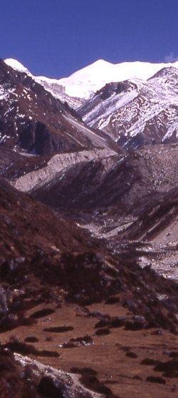
The Sarphu range forms the steep separation to the Kambachen valley where we're heading for.
Omni Kang Ri?
On the way back from Yangma and looking for a low snow-free pass to cross into the other sidevalley.
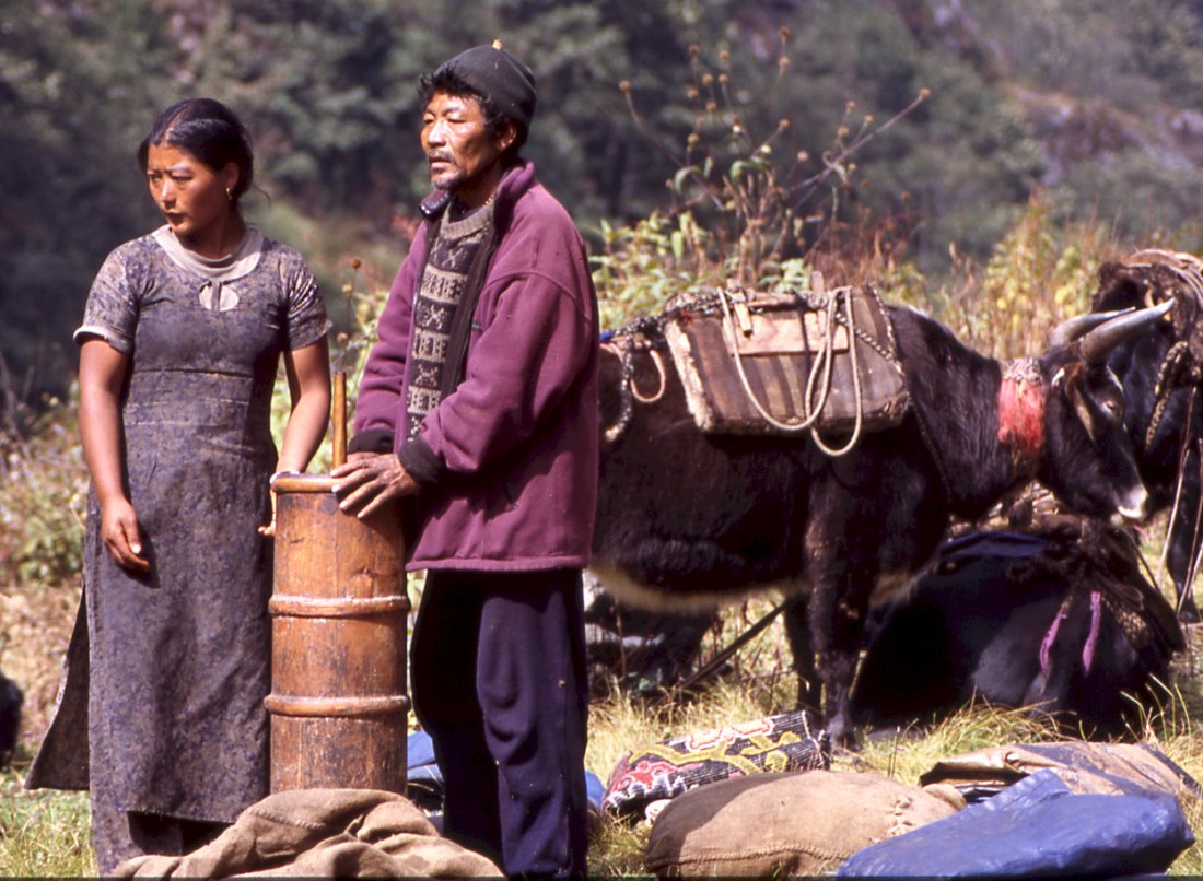
Locals from Olungchung pack up their butter churn after
lunch to climb the steep flank towards the Gyabla pass.
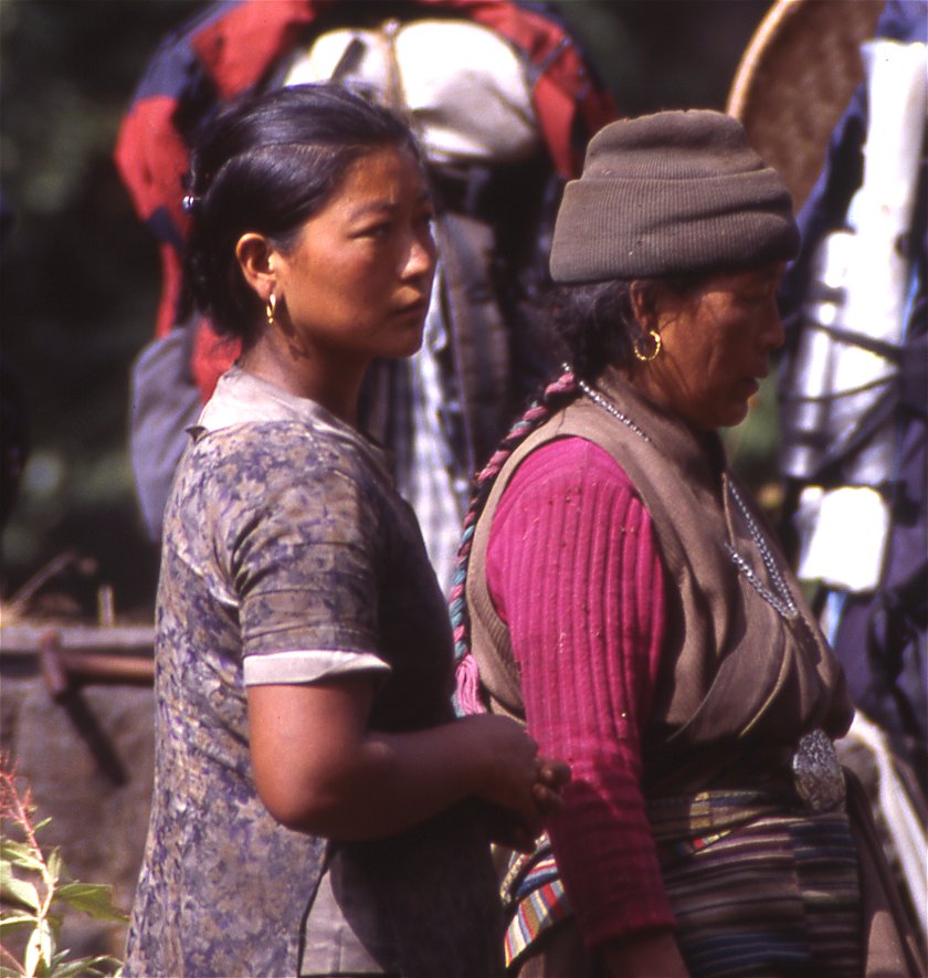
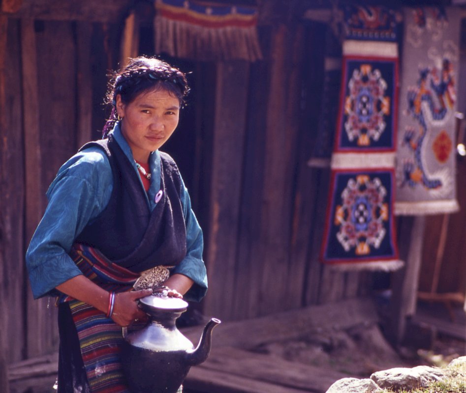
The old woman - leader of the caravan - and her daughter.
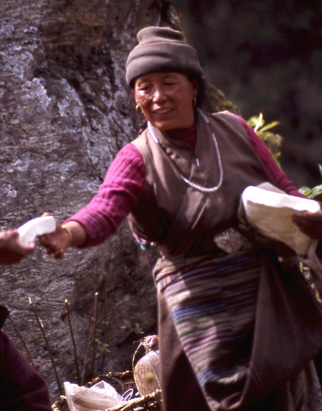
Fresh Tibetan cheese - comparable to mozarella - makes a
nice difference to the regular dish or rice and lentils.
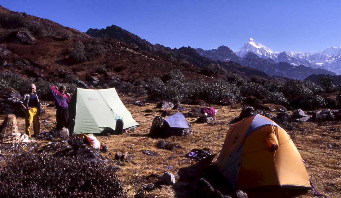
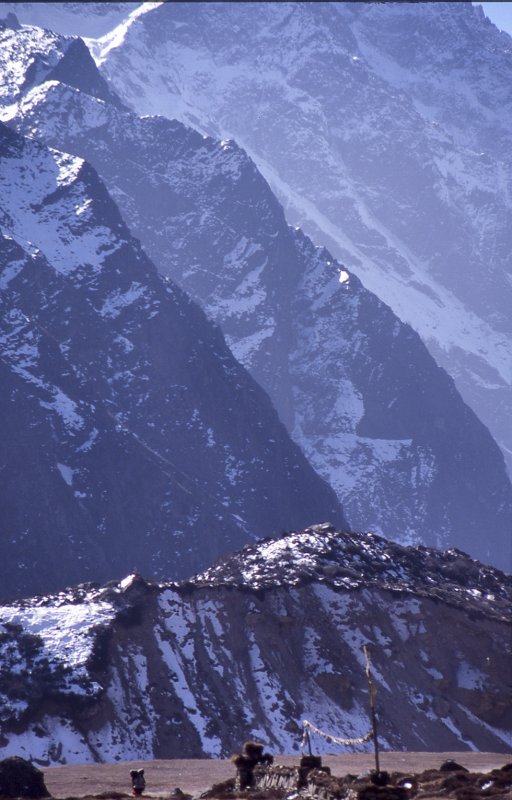
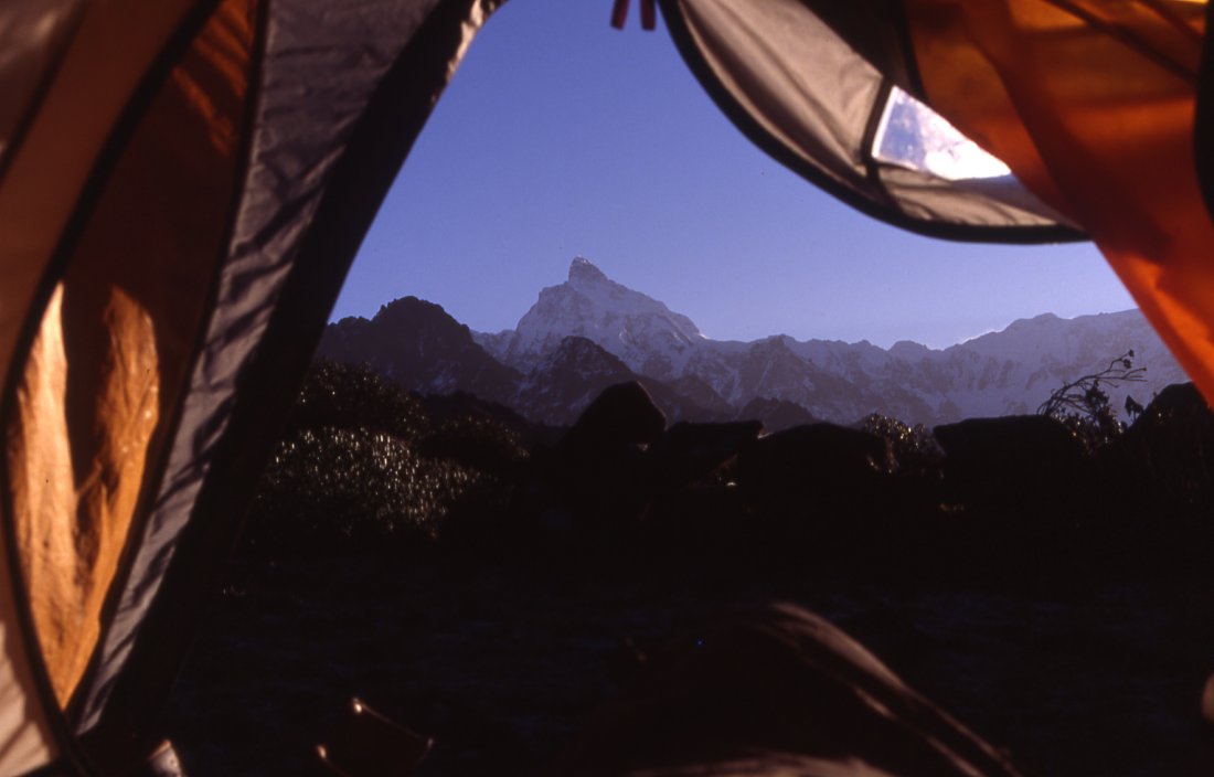
Such a view makes getting up easy - camp on the pass above
Gyable with Jannu in the background.
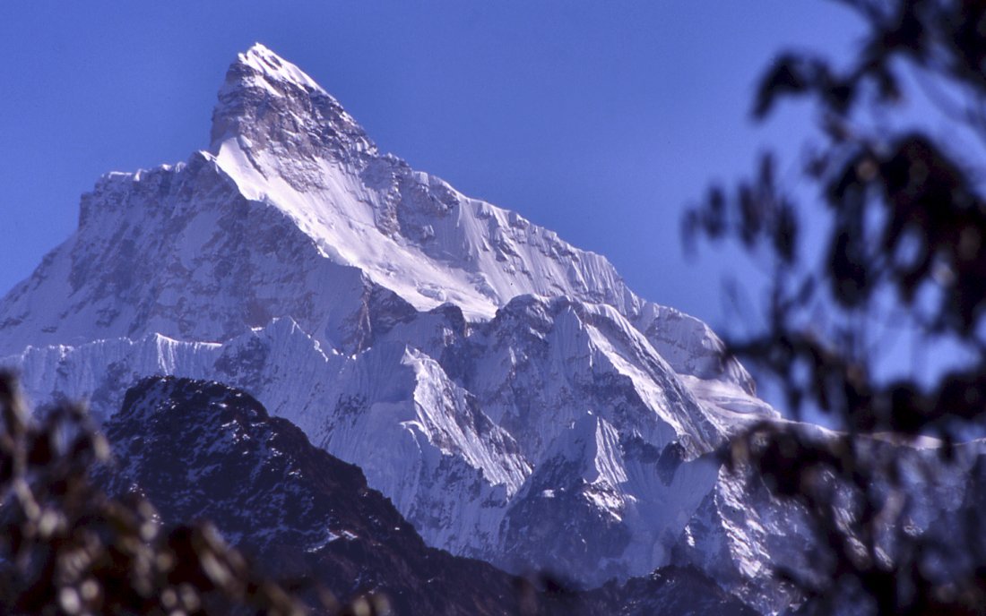
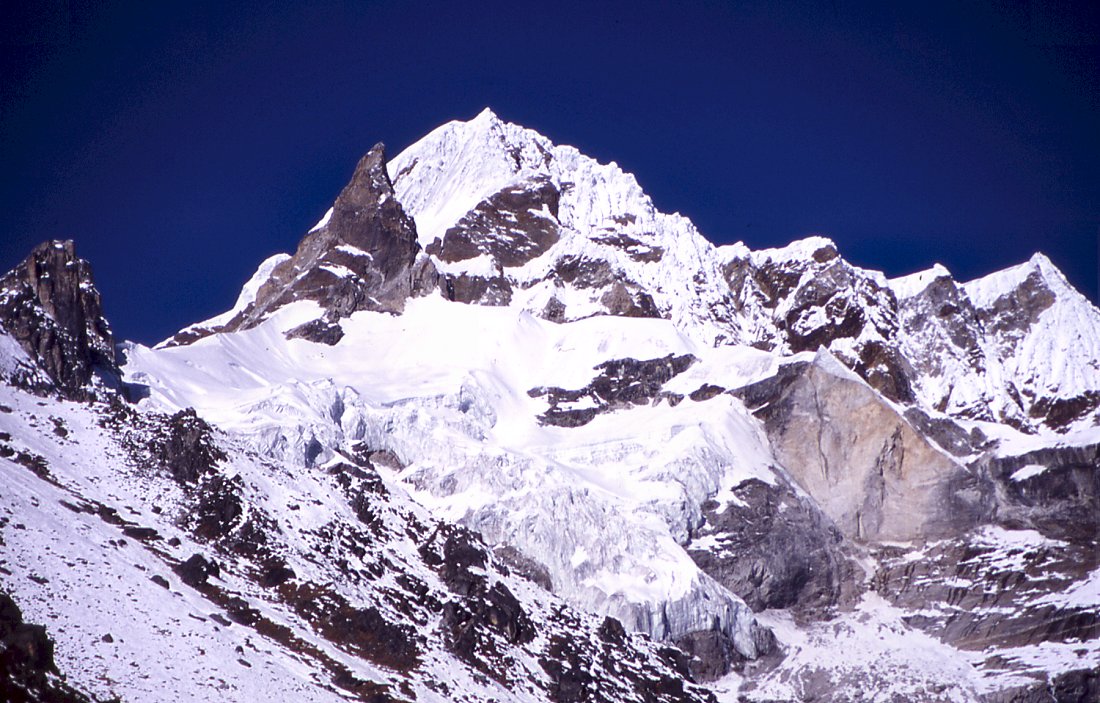
From the pass the views of Jannu are stunning.
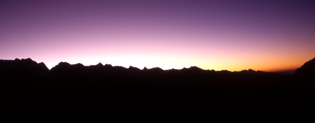
Sunrise over the Sikhali range.
Early morning.
Rhododendrons and Jannu.
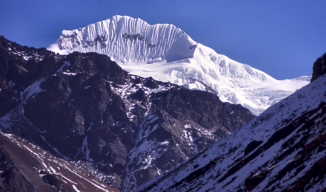
From above Gyable we enjoy the views of Jannu's tributaries, the mountain
itself hides behind them.
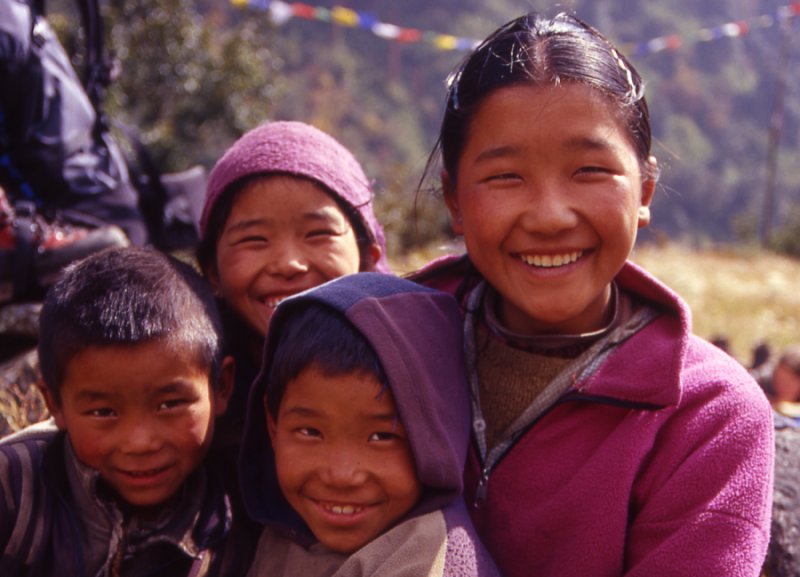
Kids in Gyable.
irl in Pholey serving butter tea.
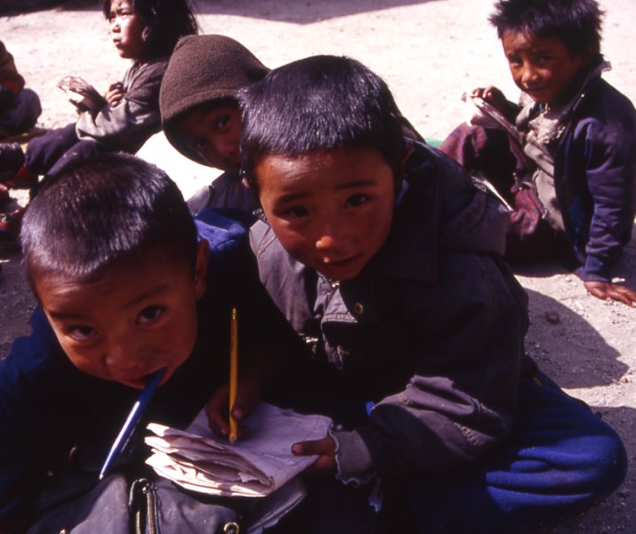
The school in Pholey teaches kids from the entire area.
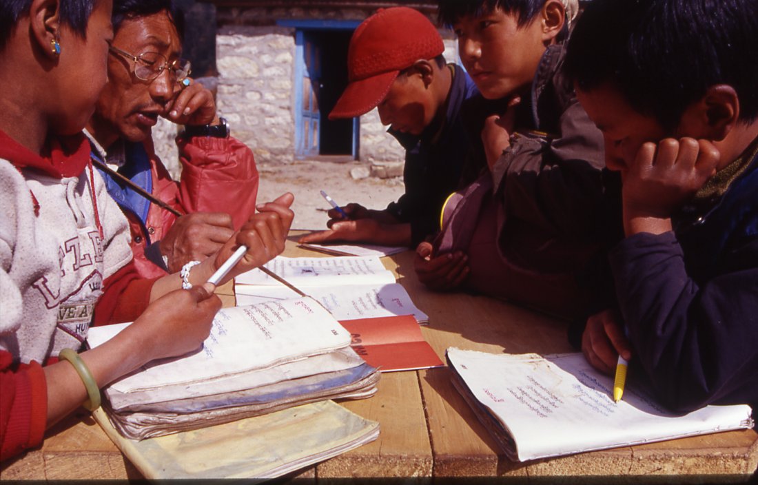
Schools are rare in the area, and many parents send their
children to the Tibetan school in Pholey.
From the village of Kambachen the valley goes north and takes a sharp turn
towards Kangchenjunga north base camp.
Sarphu from Kambachen.
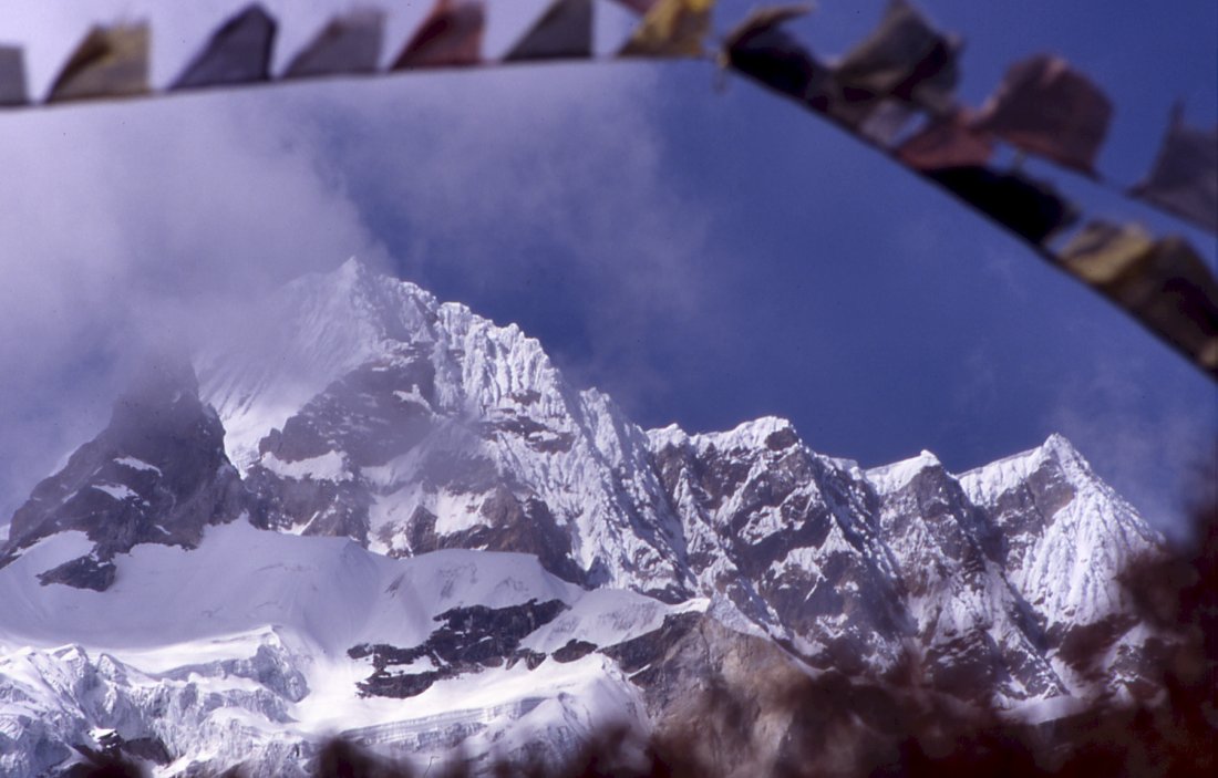
Prayerflags above the village flatter in the strong wind.
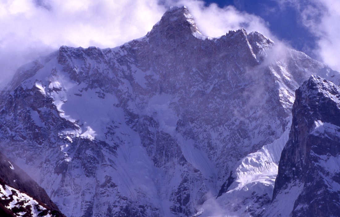
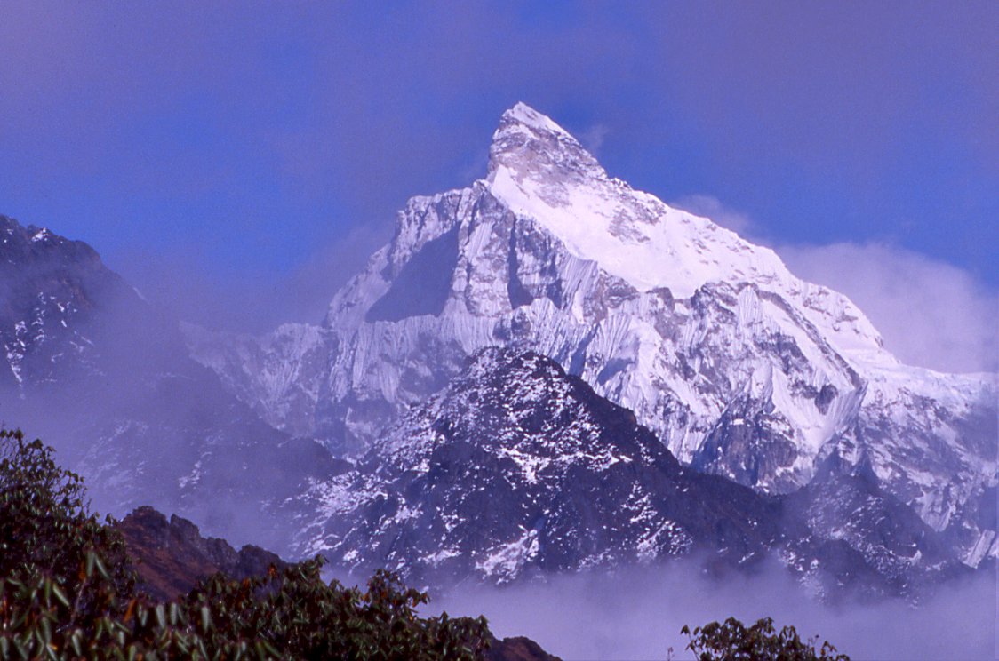
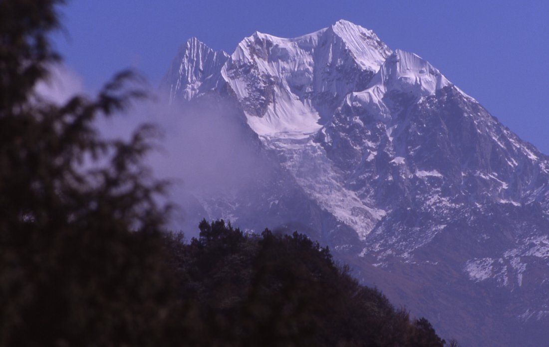
The stupenduous north face of Jannu. Parts of it have been climbed, but not
in a straight route.
Kangchenjunga Olung: Yangma - Ghunsa - Kambachen
Yangma - Gyabla - Kambachen
Yangma Forest camp (Day 16)
The sun takes longer to reach camp than we thought. Its already nine when were ready to leave. I wanted to visit the gompa but somehow I didnt feel like asking for the key. I wonder how the once proud village of 300 houses was reduced to its current size. There could be plenty of reasons: Politically or geographically blocked passes, landslides that buried the village, erosion that swept away fields, people moving somewhere else (but where to?), sickness, declining economy it could be anything.
The crew is walking fast, every time I stop for pictures I have to run to catch up. Clouds move in early, hiding glaciers and peaks. The fog makes the summits both interesting and threatening. We follow the same route as on the way up and meet several yak caravan on their way to the village. All of them are laden with wood. Unlike other villages, Yangma is both a winter and summer settlement and a lot of firewood is necessary to survive the harsh and long winter. In the old days they carried goods from foreign countries and traveled all the way to Darjeeling. It was never a major trade route, the main trail went from Kalimpong (Sikkim) to central Tibet and Lhasa, but nevertheless it was a lucrative branch.
We stop for lunch after the pass on the moraine near Jaritar. Fog has moved up since early morning and now its getting increasingly cold. Sarphu is partly hidden by a stunning black mountains that seems to be made of only one black piece of rock, little patches of snow cling to its steep flanks. Once were into the forest it feels like in another world: green and yellow are the dominating colors, moss covers everything except the trail and the top of the trees. Itd be idyllic except for the evidence of logging: huge trunks lie in the forest, its branches cut off a morbid scene like a battlefield. Countless trees were logged this way, and though Im in no position to criticize I feel sorry, also for the future generation of Yangma. There is no effort of reforestation, and every year the way to bring it to the village gets longer. Small firs grow on the inaccessible mountains, but deciduous trees are rare. In Ollungchung it didnt seem a big problem because there was much more forest, and we didnt walk through the logging areas. After the wonderful days higher up, todays long walk and the weather are a letdown and the walk in the forest has not cheered me up either. Therefore Im happy when we reach camp. A little ledge next to the trail is barely big enough for two tents, but again Ang Dami has found a nice spot between the rockslide areas. While washing in the river I find large pieces of garnet, not by smashing rocks but simply by having a closer look at the sand. It cant be much later than 18.00 when Im in my tent. Three candles and a hot water bottle create tropical temperatures, a wonderful feeling after the rather cold nights in Yangma.
Forest Camp Sera pass camp (Day 17)
We start early and the crew has increased their speed once again. Thats fine with me, getting to camp at lunchtime and having a free afternoon sounds nice. We quickly cover the distance that took us five hours on the way up. Since theres no direct trail we have to hit the Olung trail and then head down to the start of the trail that will take us to Gyable. We walk past the three houses where we spent the night before Olungchung. Half an hour further down is the beginning of the hidden pass trail, easy to find ensured us the guide. Its used by yaks quite often to get barley and corn from Gyabla; in addition Jamie was going to mark it. We pass the burned down forest, follow the green Tamur for some minutes and then meet a caravan having lunch. Six Tibetan men and two women sit around a fire and have dal baht with yogurt and cheese. Ten yaks are tethered with their horn to stones. Ang Dami has already passed them when I remind him to ask about the trail. They point up the flank and I realize weve been lucky. We would have found the trail without their help.
The men drink tongba from wooden vessels. The eldest one had a little more than his share of the alcoholic drink, and his wife has taken control of the caravan. She sells us some fresh cheese that looks like a flat mozzarella and tastes similarly, though a little stronger. They dont seem to be in a hurry, after finishing their long and leisurely meals some of the men take their huge backpacks and start. The yaks are slowly being loaded, the old man smokes a self-made cigarette, has some more tongba and after an hour of packing they start the climb towards the pass. Its just after three oclock, my initially half serious face-wash in the cold Tamur turns into a complete wash, then I sit outside the tent and lie in the sun that shines through the clouds. When fog moves in I enjoy the effect it has on the scenery. The valley with its trees suddenly looks more like a Japanese painting than a Himalayan gorge.
I play some games with the crew after lunch. Theyve gotten to know each other by now and get along very well. Im also treated a little less formal than a week ago.
Sera pass camp Hidden Pass (Day 18)
It was quite hot and I was sweating in my sleeping bag, during the pee breaks Im concerned because even in the middle of the night the fog is still lingering in the valley. In the morning the sky is clear and we start early. If I hadnt seen the yaks climbing towards the pass I wouldnt believe they can get up such steep, stony and narrow trails. Its a constant climb for an hour through thick forest and muddy grounds. At a hut we met the old women from yesterday, she watches the cattle that grazes on the plateau. From further down youd never guess theres such a large flat, tree free ground. The trail continues to climb, but instead of large trees its mainly thick and high bamboo trees. Two hours after starting we rest at another hut. Nobody is here but somebody stayed here recently. Its too early for lunch and we press on for another steep climb in a rhododendron forest on thick moss-carpeted ground. Were on a ridge now that gives the false impression of nearly having reached the top. I didnt realize the porters havent had anything to eat yet, and the glucose-sweets I handed out dont really count as meals. We open a cereal box and eat it; its quite tasty and gives energy both physically and mentally.
Haze from the south is hiding the sun. At last weve left the steepest part of the valley behind. The climb through the rhododendrons takes some time. Finally there are prayerflags on the crest, but its not the pass. Instead of descending we traverse over a secluded valley with threes and bushes that looks very peaceful.
Though I wouldnt call it mutiny, the porters are making it very clear that they are hungry. Potential discussions are stopped by the fact that Ang Dami knowingly? has taken the lead and is nowhere to be seen. We take rest, share some snacks and after a short break we climb up higher. Half an hour later, after 5 hours, theres a plateau at whose end prayerflags mark the way for tomorrow.
Were on the ridge between two deep valleys and views are extraordinary. Rhododendrons surround the small lake that reflects Jannu rising 7710 m high into the cloudy sky. From this angle it looks as if the moutain leans to the left and will soon fall over. Against the clouds even Jannu is helpless and at last the very summit disappears behind the gray wall that surrounds us now. Ang Dami waits below the lake where there is ample space for camping. Locals stay here quite often and have built stone shelters.
The upper parts of Jannu remain hidden till the evening, but further south the lower parts of Kabru mark the border to Sikkim. Hopefully the fog will clear during the night.
Hidden Pass Gyabla (Day 19)
I spend a bad night, caused by something bad I ate or drank. I wake up a few times feeling nauseous. The positive aspect is that while squatting outside I get to take some night pictures of Jannu, and to enjoy the stars. Eventually I fall asleep, and feel reasonably fine in the morning. My goal of waking up early and taking sunrise pictures without leaving the sleeping bag doesnt work because of bad tent positioning, so I get up in the cold morning.
The south spur of the chain rises as a black silhouette against the orange background while the lowland must already be in the sun. Jannu remains unimpressed for a long time, only the background changes from light blue to a whitish color. Little patches of pink rise above the Kabru ridge, the first sign that the sun will soon rise over the barrier. In a breach of the chain stands another separate mountain (maybe Rathong) which gets the sun on its southern flank and turns yellow. The silhouettes turn into figures when rock faces and glaciers start to become discernable. Finally Jannu acknowledges the new day with an orange summit, and then parts of its shoulder also change color. While the rest of the range comes to life, Jannus face does not catch more light for a long time.
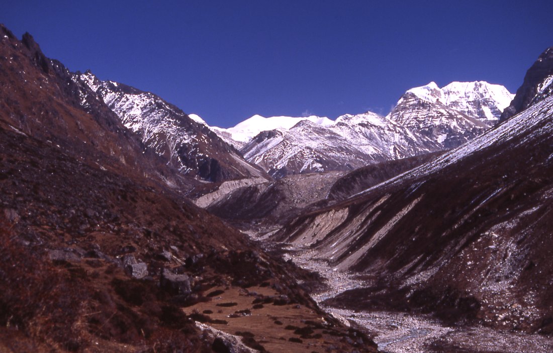
I skip breakfast, both to accommodate my stomach and to use the time for sightseeing and climb the three hills surrounding the camp. A moderately easy walk takes me up a grassy slope to the northwest from where I spot another peak rising behind Jannu, probably Kambachen (7903 m). Most interesting is the view towards north, La Samba Danda is right in the front and the monastery of Olungchungkola clearly stands out from the ochre hillside. The wild creek menders peacefully or so it seems from Dingsamba camp to Olungchungkola. A long range of the partly snowed I mountains forms the end of picture, where the Tipta La pass lies is difficult to say. The Nurak Khola valley that is part of the Yangma valley is fully visible at first, but then the most interesting upper part is blocked by hills. Only one enormous mountain rises above the ridges, my guess is that its Syao Kang.
Another viewpoint is the black hill north of the camp, probably half an hour climb. Mangal, the oldest porter, is just descending. If Kangchenjungas main summit were visible Id climb up, but Jannu probably hides it and I should take it easy after the bad night.
The lake is partly frozen at its outflow, the porters have seen a maelstrom in the middle but it has disappeared when I get there. The plateau is barren, just below the pass rhododendrons grow. After ten minutes the trail peters out. Ang Dami walks up another ridge, an unlikely route. Phurwa, the other porter, looks a little further down into the gully and after watching for a minute, takes his load and starts descending. From a clearing in the dense forest we hear his call and follow him. Ang Dami soon catches up. From then on the trail is clear, it descends in the quickest possible way straight down the steep valley. Both valley walls look incredible steep, but the trail clings to the northern one and doesnt seem very precipitous when walking on it. We quickly lose altitude, and not even two hours after starting the wide fields and wooden houses of Gyabla appear below us. Framed by colorful trees and bushes. It seems much more lush and autmnier than on the other side, but maybe thats just because starring at the impenetrable snow summits for much of the morning. The first fields start high above the first house. A women is working on a potato field, and seems a little surprised to see us. Through thorny bushes we reach the first house that is idyllically framed by a tall fir tree, and the high ridges of Jannu.
Many trails lead through fields and bushes, there isnt an actual village, insteead just a collection of wooden houses that are spread over a large area.
Wheat is grown on the wide flat fields. Harvest is over already, and new sprouts are already growing. In winter snow falls knee-deep but most people stay in the village. Who else is gonna feed our dzos? says an old man I ask about the seasons. He fled Tibet 30 years ago and settled here. The current situation in Nepal concerns him deeply, the villagers are being pressured both my Maoists and the government, and less tourists are coming. He doesnt want to be involved at all. Actually he doesnt even feel being Nepali. He received the citizenship because it makes life much easier than being a refugee. A few times he refers to the rongba dugcha, the bad valley people. Once more its interesting to note that not the high passes form the border, rather its the middle hills. If the government solution with Nepalization through education is the right way to build a nation is debatable. The children of Gyabla go to school in Phele, three hours further north but today all the kids are around and some ask rather aggressively for pens and chocolate.
We get to the campsite at the end of the village in the early afternoon, just as some porters in familiar red-yellow suits arrive from Ghunsa. I follow them and meet Ram Kaji, a sirdar with whom I went to Kangchenjunga in spring 2 years ago. Hes with a group of Germans; one of them is very friendly. They started in Yamphudin, crossed a pass and went to Pangpema where they met the others from my group. Everybody knows were trying to climb Mera, even the 55 year old Tibetan refugee, but I assume all the remotely with government involved people have fled the area some time ago. The crew is friendly, offers juice and even lunch but I decline because I dont want to test my stomachs capabilities yet.
A local talks about the Maoists up here, and the wildlife that includes red pandas, black panda (he probably refers to black bear) and other bears. After seeing a familiar face it takes a few moments until I realize its our guide from Olungchungkola. They crossed safely in snow-free conditions, but something has happened to one yak. My Tibetan is not good enough to understand what really happened. He explains me that Jamie has left a note at the pass. We didnt see it and it hopefully didnt contain anything very important.
It clouds up quickly, and the large waterfall looks only half impressive when the clouds cover the mountains faces high above it.
Gyabla Ghunsa (Day 20)
A warm night, though the wind in the morning makes me skeptical. When I finally open the tent it is very cloudy already. We pack quickly and meet one of the porters who was with us. He came up to Olungchung, turned back to Suketar and found work for another group. Like on previous days we walk fast. Our speed impresses even the porters. Were flying up along the green-whitish river and hear them laugh bistari bistari behind us (slowly, slowly in Nepali).
The vegetation seems unspoiled by humans. Large trees rise above the thick forest. Red maple leaves and yellow fir needles cover the ground. The water level during spring (melted snow) and summer (monsoon) must be incredibly high. The current has placed large boulders on top of huge boulders that stand in the middle of the river 3 meters above the current water level.
The point where we cross under a boulder thats squeezed between two rocks marks the entrance into a different world. The valley seemed dull compared to the new scenery: birds are chirping, the soft trickling of a creek comes from between green rhododendron bushes and some orange butterflies are carried away the warm wind. We reach the first fields and houses of Pholey. Harvest was finished and the houses are empty. Half an hour further up the roof of the monastery looks out of the forest, and were in the proper village and stop for lunch. Three groups of yaks come down, carrying potatoes from Ghunsa to Gyabla. The kids are asking for pens, though later I see that they dont just collect them for fun but really need them for school. I visit the school on the way to Ghunsa. Tibetan Children Village is an organization closely affiliated with the Tibetan government in exile. Three teachers cover English, Nepali and Tibetan and teach children from the entire area. Kids from Yangma, Olugchungkola, Ghunsa and Gyabla are staying at the school, those from remote areas stay in the hostel. When the school year will finish in two weeks they will go home and return in Mid-February when the school opens again. People in Yangma dont have a choice of school since theirs is without a teacher. But I couldnt find out why Olungchungkola sends some students to Phele, their local school looked fine. The
I pass another monastery, one that I havent visited last time. Since Im not in the mood of exploring today, I decide to postpone the visit.
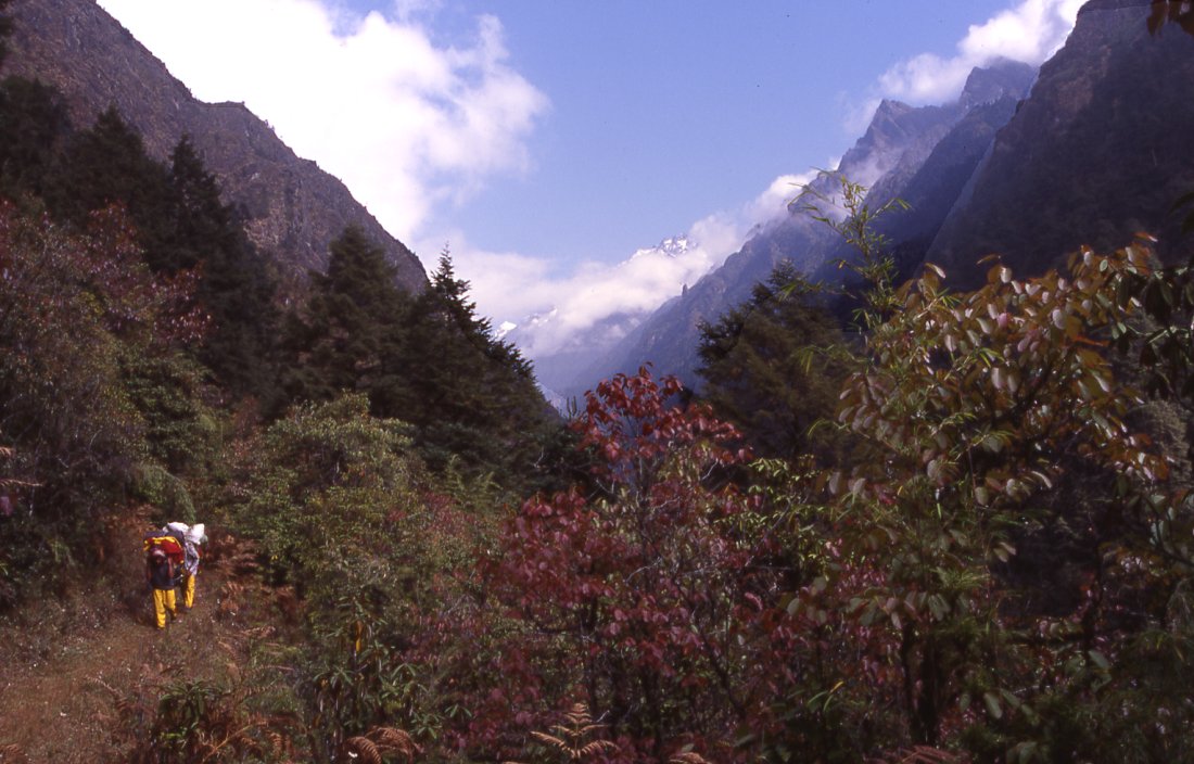
After a cloudy morning the noon is hot and sunny, now mist moves in and makes the yellow larches stand out. An hour after leaving Pheley, the village of Tibetan refugees, I see the first houses of Ghunsa where Bhotias (Tibetans who came a long time ago) live. There seems to be some reservation between Yangma, Gyabla and Ghunsa, though if thats more than the usual relationship and competition between neighbors is hard to tell.
The walk through the autumn forest is pleasant but short. I meet Tsering, the daughter of the guesthouse owner where I stayed during the last visit to the area. She smiles when she sees me, I also remember her well. Before entering the village, I pass the gompa without paying a visit and cross the old bridge. Mangal waits further down and brings me to the guesthouse of which there are quite a few. The couple who owns the lodge seem reasonably wealthy. The owner runs the local KCAP station. Their daughters Angmu and Tashi Dolma are 12 years old and fun, theyre surprised at my Tibetan and bombard me with questions. After a hot shower I feel like on the first day of trekking. Then I do some laundry and relax in the beautiful living room. Its big, has glass windows and the usual display of kitchen utensils. A bench with thick Tibetan carpets is on the window front, sadly clouds move in early and since the windows dont face the main through-faire there is little to see. Im about to be splattered with yak meat that the ajala is cutting with a big knife. Apart from that, its wonderful to sit here, listen to the crackling of the fire and enjoy a lazy afternoon. The atmosphere both from the people and their living room is very cozy.
A larger group has just arrived and stays at the lodge where I spent two nights some years ago. So the owners are quite busy. The mother looks as last time, maybe even younger, and offers me a seat and a cup of Tibetan butter tea with little butter and salt. Its very tasty, and mild (at home I add both in large quantities and also milk, but the ingredients at home have not such a strong taste as here). And then comes the dish of boiled potatoes with a little salt and chili which taste delicious - and brings back memories from the last time when I arrived after a rush from Lhonak in 4 hours, just before the downpour, and very very hungry. Ive had a leisurely walk this time, but the potatoes taste still fantastic.
Dinner in the living room is nice, though when some visitors from the other group arrive Ang Dami doesnt seem to feel very comfortable with them. After some time our crew gets more involved and included, but still its a bit awkward and well have breakfast in the kitchen shack the next morning.
Ghunsa Kambachen (Day 21)
It was cold this night, and though the sun reaches the upper part of the valley quickly the village gets the sun last. The crew slept in the kitchen shack which looks not so warm, but they claim it was ok and better than the tent. We have a very quick breakfast and pack. The goal is to get as far as possible before clouds move in after noon.
This part of the valley gets a lot of frost and both the crew and I are eager to get moving. Thondrup, the owner of the local shop, was trying to get the lama to open the monastery across the river for me this morning, but the monk hasnt arrived by the time were ready to leave.
The forest after the village is enchanting, the small trail passes between gnarled trees that grow along the trail. Steep precipes on our right are covered by snow. Melting water has created wide river beds that cut through our route. Now they seem dry, but it is deceptive. I slip on a boulder that is covered by ice, it's a miracle that I manage to prevent a serious injury and "only" cut the top of my thumb. Pain is intense for the next two hours.
We cross the river and have lunch on a clearing in the last patch of forest. Different birds live in the bushes, and while waiting for lunch, it's interesting to see the variety. The river bed looks increasingly glacial, the trail climbs higher up and then we see the tip of Jannu. After crossing a wide landslide area we're literally just across one of the most stupendous mountain faces on earth. The reddish vertical wall rises above the glacier, seemingly endless it rises into the sky.
Another glacier is coming from north, a white range forms the horizon and the border. In the entrance of a western sidevalley lies the village of Kambachen. People from Ghunsa live here during the summer to watch yaks, and during autumn to run little shops. Therefore the houses are very simple, the wooden houses are not very attractive but the hospitality of the people make them comfortable. The owner hands me a note from Jamie: the amount of snow will make it difficult to attempt Mera peak, they went to Lhonak in hope for less snow. They'll be here tomorrow around noon, and we can discuss alternatives.
Kambachen is a cold place, and after sunset we quickly retreat into the sleeping bags.
|
Summary Part 5:
From Yangma we descend in the beautiful valley. The pass over the Nango La has too much snow, so we walk down another day to look for the pass to Gyabla. A tough climb on small trails takes us to the pass where we set up the most stunning camp next to a little lake between rhododrendrons and stunning views of Jannu. In Gyabla we enjoy the tranquil atmosphere and the company of the locals. The walk in the old forest to Pholey is pleasant. On the way to Ghunsa the vegetation changes, instead of green it is the red and yellow of larches that dominates. Jannu displays its most impressive side: the stupendous north face consists of a mile of vertical red rock that culminates in a fine symmetrical summit covered by snow. Nobody has climbed the face from bottom to top, though every year noble attempts are started. A fine glacial valley leads further north to Lhonak and Pangpema. For me it's time to wait for the others and head back to Ghunsa for the traverse to the south side of Kangchenjunga. |